
Hey there! Some links on this page may be affiliate links which means that, if you choose to make a purchase, I may earn a commission at no extra cost to you. I greatly appreciate your support. Read the full disclosure here.
Bug out route planning from the city means pre-selecting multiple escape paths out of your urban area before a crisis forces you to leave under pressure. The goal is to identify primary and backup routes by vehicle, bicycle, and foot — accounting for traffic, road closures, hazard zones, and your specific destination — so that when the moment comes, you move with purpose instead of panic.
Key Takeaways
- Every urban prepper needs at least three pre-planned routes out of their city: one primary, two alternates.
- Routes must account for traffic gridlock, which historically chokes major highways within hours of a declared emergency.
- Your bug out bag should support 72 hours minimum of independent travel without resupply.
- Large cities require more layered planning than small towns due to population density, bridge chokepoints, and tunnel bottlenecks.
- Special needs — mobility limitations, infants, elderly family members, pets — must be built into the route plan, not added as an afterthought.
- Offline mapping tools (paper maps + apps like Gaia GPS or Maps.me) are non-negotiable because cell networks fail during mass evacuations.
- Family coordination and pre-assigned rally points are just as important as the routes themselves.
- Route planning differs significantly between earthquake zones, hurricane corridors, and flood plains.
What Exactly Is a Bug Out Route — and Why Do You Need One?
A bug out route is a pre-planned escape path from your current location (usually your home or workplace) to a safer destination outside the danger zone. It’s not improvised. It’s researched, mapped, tested, and memorized before anything goes wrong.
Here’s the hard truth most people miss: when a real emergency hits a city, the roads don’t just get busy — they lock up completely. During Hurricane Katrina in 2005, contraflow lanes on I-10 out of New Orleans were overwhelmed within hours. During the 2003 Northeast blackout, millions of people had no plan at all. Waiting until the emergency to figure out your exit is the single most dangerous thing an urban prepper can do.
Bug out route planning from the city guide framework exists because cities are uniquely hostile environments during a crisis:
- High population density means everyone is trying to leave at once.
- Infrastructure chokepoints — bridges, tunnels, highway on-ramps — become instant bottlenecks.
- Civil unrest can block or make certain corridors dangerous.
- Fuel shortages hit urban gas stations within 24–48 hours of a declared emergency.
A solid route plan solves all of this before the clock starts. For a deeper foundation, the ultimate guide to creating a bug out plan is an excellent starting point.
What Are the Top 3 Scenarios Where You’d Actually Need a Bug Out Route?
Most preppers will never face a full societal collapse. But these three scenarios are statistically likely enough that every urban resident should plan for them:
1. Natural Disaster (Imminent or Ongoing) Hurricanes, wildfires, floods, and earthquakes can make entire city zones uninhabitable within hours. Mandatory evacuation orders give you a window — but that window closes fast. Having a pre-planned route means you leave in the first wave, not the last.
2. Infrastructure Failure (Grid Down / Water Contamination) Extended power outages, water system failures, or fuel supply disruptions can make urban living untenable within days. This is a slower-burn scenario, but the exit strategy is the same. Check out the EMP attack and grid failure survival guide for how quickly urban infrastructure can cascade.
3. Civil Unrest or Localized Violence Riots, targeted attacks, or widespread civil breakdown can make specific neighborhoods or corridors impassable. Your route plan needs to account for areas to avoid, not just roads to take.
Decision rule: If any of these three scenarios applies to your region — and statistically, at least one does — bug out route planning from the city isn’t optional. It’s the baseline.
How Do I Choose the Best Escape Route Out of My City During an Emergency?
The best escape route avoids major highways, crosses the fewest chokepoints, and leads to a pre-stocked destination. Choosing it requires research done in advance, not during the crisis.
Step-by-step route selection process:
- Identify your destination first. You need somewhere to go — a family member’s property, a rural cabin, a campsite, or a pre-positioned cache. Without a destination, you’re just driving blind.
- Pull up a physical map of your metro area. Mark your home, workplace, and any locations where family members might be when a crisis hits.
- Identify all major exit corridors (interstates, state highways, county roads) and mark the chokepoints: bridges, tunnels, rail crossings, and single-lane roads.
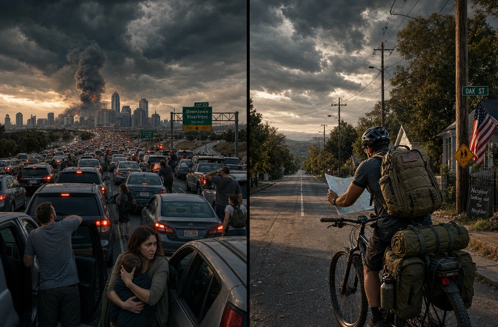
- Plot three routes: one primary (fastest under normal conditions), one secondary (avoids major highways), one tertiary (on foot or bicycle if vehicles are impossible).
- Drive each route at different times of day. Note fuel stations, water sources, cover positions, and potential hazards.
- Mark rally points — intermediate locations where your family can meet if separated.
For a comprehensive framework, the ultimate evacuation plan guide walks through this process in detail.
Common mistake: Most people default to the interstate because it’s familiar. In an emergency, the interstate is the last place you want to be. Secondary state highways and county roads move faster when the main arteries are gridlocked.
How Do I Map Multiple Bug Out Routes in Case Primary Paths Are Blocked?
Plan for your primary route to fail. It will. Map a minimum of three distinct paths that don’t share critical chokepoints.
The three-route framework:
| Route Type | Method | Best For |
|---|---|---|
| Primary | Vehicle, fastest path | Early evacuation, pre-crisis departure |
| Secondary | Vehicle, alternate roads | When primary is gridlocked or blocked |
| Tertiary | Foot or bicycle | When all vehicle routes fail |
Each route should be documented on a laminated paper map with the following marked:
- Fuel stops (with estimated distance between them)
- Water sources (streams, rivers, public buildings)
- Rally points for family members
- Hazard zones to avoid (flood plains, industrial areas, known civil unrest corridors)
- Shelter options if overnight travel is required
Offline mapping apps like Gaia GPS, Maps.me, or onX Hunt allow you to download entire regions for offline use. These work when cell networks are down. Always pair digital tools with a physical backup — batteries die and screens crack.
Learning navigation without GPS is a skill every urban prepper should develop before they need it.
What Supplies Should I Pack in My Bug Out Bag for Urban Evacuation?
Your bug out bag for urban evacuation should sustain you for 72 hours minimum, be light enough to carry on foot, and contain everything you need if you lose your vehicle mid-route.
Core categories for an urban bug out bag:
- Water: 1 liter minimum on your person, plus a quality filter (Sawyer Squeeze or LifeStraw) for sourcing water en route
- Food: High-calorie, lightweight options — energy bars, freeze-dried pouches, jerky. Avoid anything requiring cooking in early evacuation phases.
- Navigation: Laminated paper maps of your region, a compass, and a charged offline-capable smartphone
- Communication: A battery-powered or hand-crank emergency radio, a fully charged power bank, and a list of emergency contacts in writing (not just in your phone)
- First aid: A compact trauma kit including tourniquets, wound packing gauze, and any prescription medications (minimum 7-day supply)
- Shelter: An emergency bivy or compact tarp — urban evacuations can turn into overnight scenarios fast
- Documents: Copies of ID, insurance, financial records, and emergency contacts in a waterproof pouch
- Tools: A fixed-blade knife, multi-tool, fire starter, and a small flashlight with extra batteries
For a full breakdown, the complete bug out bag guide covers every item category with weight and cost considerations. Also avoid the most common packing errors covered in the bug out bag mistakes guide.
Weight rule of thumb: Your loaded bag should not exceed 20–25% of your body weight for sustained foot travel. Overpacking is one of the most common and costly mistakes urban preppers make.
How Different Are Bug Out Routes for Small vs. Large Cities?
The core principles are the same, but large cities require significantly more layered planning. Small cities (under 100,000 people) typically have multiple viable exit routes that won’t saturate quickly. Large metro areas (500,000+) face exponentially harder evacuation math.
Large city-specific challenges:
- More bridges and tunnels that become instant chokepoints
- Greater distance to rural or low-density areas
- Higher likelihood of fuel shortages within 12–24 hours
- More complex family coordination across greater distances
Small city advantages:
- Fewer competing evacuation routes means less gridlock
- Shorter distance to rural safety zones
- Easier to pre-position supplies at a destination
For large city residents, add these layers:
- Pre-position a vehicle or bicycle outside the densest urban core (a storage unit in the suburbs, for example)
- Identify neighborhood-level exit paths, not just regional highways
- Plan for the possibility of a multi-day on-foot exit if vehicles are impossible
- Consider a staged evacuation: move to a suburban staging point first, then continue outward
The ultimate urban survival guide covers the full complexity of large-city preparedness.
Are Bug Out Routes Different in Earthquake vs. Hurricane Zones?
Yes — significantly. The hazard type changes which routes are viable, how much warning time you have, and what infrastructure you can count on.
Hurricane zones:
- You typically have 24–72 hours of warning. Use it to leave early.
- Storm surge maps and flood zone designations should directly shape your route — avoid low-lying coastal roads.
- Pre-planned routes should lead inland and away from projected storm paths.
- Fuel up your vehicle 48–72 hours before projected landfall, not the night before.
Earthquake zones:
- Zero warning time. Your route must be memorized and practiced, not planned in the moment.
- Post-quake, bridges and overpasses may be structurally compromised. Your tertiary (foot) route becomes critical.
- Gas lines may be ruptured — fire risk near industrial areas is elevated.
- Plan for aftershocks making roads impassable for hours or days.
Flood zones:
- Never drive through standing water. The “turn around, don’t drown” rule exists because moving water as shallow as 12 inches can sweep a vehicle.
- Routes should prioritize elevation gain, not just distance from home.
The geographic threat prep guide by US region is one of the most useful resources for tailoring your plan to your specific threat environment.
Which Routes Are Best If I Have Limited Mobility or Medical Needs?
Mobility limitations and medical needs don’t disqualify you from effective bug out route planning — they just require more specific preparation. The key is building accommodations into the plan before the emergency, not improvising during one.
For limited mobility:
- Identify routes with the fewest elevation changes for foot travel
- Pre-arrange transportation with a trusted neighbor or group member
- Keep an accessible vehicle (hand controls, ramp, or lift-equipped) fueled and ready
- Mark accessible rest points along each route
- Consider a mobility-specific bug out bag: lighter, with a focus on medical supplies over heavy gear
For ongoing medical needs:
- Maintain at least a 30-day supply of critical medications, rotated regularly
- Identify medical facilities along each route (not just at the destination)
- Carry a written medical summary — conditions, medications, allergies, blood type — in your documents pouch
- If oxygen or power-dependent equipment is required, identify power sources along your routes and at your destination
For seniors specifically, the disaster prep strategies for seniors guide addresses these considerations in depth.
How Do I Coordinate a Bug Out Plan With My Family?
A bug out route is only as good as the people who know it. Family coordination is where most plans fail — not in the mapping, but in the communication.
The family coordination framework:
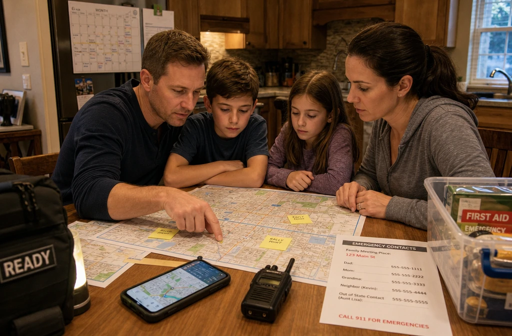
- Hold a family planning meeting. Walk through every route on a map together. Everyone old enough to understand should know the primary destination and at least one rally point.
- Assign roles. Who grabs the bug out bags? Who handles the pets? Who is responsible for the youngest children or elderly family members?
- Set communication protocols. Agree on check-in times, a primary contact outside your city (often easier to reach than local numbers during a crisis), and a text-first policy (texts go through when calls don’t).
- Establish rally points. Pick two or three intermediate locations — a specific intersection, a landmark, a relative’s house — where family members can meet if separated.
- Practice. Run a dry drill at least once a year. Drive the routes. Time them. Identify what you missed.
The ultimate family emergency plan template provides a printable, step-by-step system for documenting all of this. For communication-specific planning, the emergency communication plan guide covers radio protocols, out-of-area contacts, and digital backup strategies.
What Technology Can Help Me Track and Update My Emergency Routes?
The right tools make bug out route planning from the city more accurate and easier to maintain. The wrong tools — ones that depend entirely on cell service — can leave you blind at the worst moment.
Recommended tools by category:
Offline mapping:
- Gaia GPS — downloadable topo maps, route marking, waypoints. Works without cell service.
- Maps.me — free, offline city and regional maps. Good for urban navigation.
- onX Hunt — excellent for rural and off-road route planning beyond the city limits.
Communication:
- BaoFeng UV-5R or similar handheld ham radio — for communication when cell networks are down (requires a Technician license, which takes one afternoon to study for)
- Garmin inReach — satellite communicator for two-way messaging anywhere on Earth, no cell required
Navigation backup:
- Physical USGS topo maps for your region (available at REI, online, or through state agencies)
- A quality baseplate compass — Silva or Suunto are reliable choices
Route documentation:
- Google My Maps (save offline) for initial planning
- A printed, laminated route card for each family member’s bug out bag
Important caveat: Every digital tool should have a non-digital backup. Cell networks, GPS satellites, and app servers have all failed during real emergencies. Paper maps and a compass are not optional extras — they’re your foundation.
How Much Does Professional Bug Out Route Planning Cost?
Most bug out route planning from the city can be done at zero cost using free tools and publicly available maps. Professional services exist but aren’t necessary for most preppers.
Cost breakdown:
| Item | Cost Range |
|---|---|
| USGS topo maps (printed) | $8–$15 each |
| Laminated regional road maps | $5–$12 |
| Gaia GPS premium subscription | ~$40/year |
| Garmin inReach Mini 2 (satellite communicator) | $350–$400 |
| BaoFeng ham radio | $25–$35 |
| Professional evacuation consultant | $200–$500+ per session |
The honest assessment: Professional consultants can add value for complex situations — large families, medical needs, or high-risk urban locations. For most preppers, investing time in self-directed planning using free tools and quality guides will produce a better result than a single paid consultation, because you’ll understand your own plan deeply enough to adapt it in real time.
What Are Common Mistakes People Make When Planning Emergency Evacuation Routes?
Most bug out route failures are predictable and preventable. These are the mistakes that show up repeatedly:
- Planning only one route. When that route fails — and it will — there’s no backup.
- Defaulting to the interstate. Major highways gridlock within hours during a mass evacuation.
- Never driving the routes. A route that looks clean on a map may have a seasonal bridge closure, a gated community, or a dead-end that doesn’t show up digitally.
- Ignoring fuel range. Many urban preppers don’t account for the fact that traffic jams burn fuel at idle. Calculate your fuel needs at 50% of highway efficiency.
- No offline maps. Cell networks fail. If your entire navigation plan lives in Google Maps, you’re one tower outage away from being lost.
- Forgetting the human factor. Family members at school, work, or across town need to know the plan and their role in it.
- Not accounting for time of day. A route that takes 45 minutes at 2 a.m. may take 4 hours at 5 p.m. on a weekday. Test your routes at different times.
- Skipping the destination. “Get out of the city” is not a plan. You need a specific, pre-arranged destination with supplies waiting.
Conclusion: Build the Plan Before You Need It
Bug out route planning from the city isn’t a one-afternoon project — it’s a living system that gets stronger every time you test it, update it, and practice it with your family. The preppers who move confidently during a crisis aren’t lucky. They’re prepared.
Your actionable next steps:
- This week: Pull up a physical map of your city. Identify your three exit corridors and mark the chokepoints on each one.
- This month: Drive all three routes at different times of day. Document fuel stops, water sources, and rally points.
- Within 60 days: Build or update your bug out bag to support 72 hours of independent travel. Review the 72-hour bug out bag checklist to make sure nothing critical is missing.
- Ongoing: Hold a family meeting, assign roles, and run at least one drill per year. Update your routes seasonally or after any major infrastructure change in your area.
Preparedness isn’t about fear. It’s about having the confidence to protect the people you love when the unexpected happens — and it starts with knowing exactly how you’re going to get out.
Frequently Asked Questions
How many bug out routes should I have? At minimum, three: one primary vehicle route, one alternate vehicle route, and one on-foot or bicycle route. The more chokepoints in your city (bridges, tunnels), the more alternates you need.
Should I tell people about my bug out route? Share it only with trusted family members and your immediate preparedness group. Operational security matters — broadcasting your route or destination increases risk during a crisis.
What if my family is spread across the city when an emergency hits? Pre-designate rally points at logical intermediate locations — a school, a major intersection, a relative’s house — and establish a communication protocol so everyone knows where to go if they can’t reach home.
Can I bug out without a vehicle? Yes, and you should plan for it. A bicycle covers ground 3–4 times faster than walking and can navigate traffic jams that stop cars entirely. A loaded bicycle with panniers can carry a full bug out bag comfortably.
How often should I update my bug out routes? Review them at least twice a year, and immediately after any major road construction, bridge closure, or infrastructure change in your area. New developments, seasonal flooding, and changing neighborhoods can all affect route viability.
What’s the difference between a bug out route and an evacuation route? They’re closely related. An official evacuation route is designated by local authorities for mass movement. A bug out route is your personal, pre-planned path — often different from official routes specifically to avoid the gridlock those routes create.
Do I need a ham radio license to use a two-way radio during an emergency? In a genuine life-safety emergency, FCC rules allow unlicensed use of any radio. That said, getting a Technician license is straightforward and allows you to practice legally before you need the skill.
What if I live in a high-rise apartment? Your route planning starts inside the building: know every stairwell exit, the roof access (if applicable), and the fastest ground-level exit in multiple directions. From there, the same city-level planning applies.
How do I plan a bug out route if I have pets? Map routes that allow for pet carriers or leashed animals, identify pet-friendly shelter options at your destination, and add pet supplies (food, water, medications, records) to your bug out bag. The pet emergency preparedness checklist covers this in full.
Is bug out route planning different for renters vs. homeowners? The route planning itself is identical. The difference is in your destination — renters may need to pre-arrange shelter at a family member’s property or identify campsite options, since they typically don’t have a secondary property to fall back on.
Products, Tools, and Resources
These are the tools that experienced preppers actually use for urban route planning — not the most expensive options, but the most practical ones.
Gaia GPS Premium — The gold standard for offline topo mapping. Download your entire region before a crisis. The premium tier (~$40/year) unlocks satellite imagery overlays that are genuinely useful for scouting routes beyond the city.
Garmin inReach Mini 2 — When cell networks fail, this satellite communicator lets you send and receive messages from anywhere. It’s not cheap, but for a family coordinator managing multiple people across different routes, it’s invaluable.
DeLorme State Atlas & Gazetteer — These large-format paper maps cover every county road, fire road, and trail in your state. Far more detailed than standard road maps and available for every U.S. state. Keep one in your vehicle at all times.
BaoFeng UV-5R Ham Radio — At roughly $25, this is the most cost-effective communication tool in any prepper’s kit. Pair it with a Technician license (easy to obtain) and you have city-wide communication capability that doesn’t depend on cell towers.
Sawyer Squeeze Water Filter — Lightweight, reliable, and rated for 100,000 gallons. Essential for any route that might extend beyond your carried water supply. Works with any freshwater source along your path.
Silva Ranger Compass — A quality baseplate compass is the backup to every digital navigation tool you own. The Silva Ranger has been a reliable choice for decades and costs under $50.
For a complete gear audit, the essential survival gear guide ranked by priority is a thorough, experience-based resource that covers everything from navigation to shelter.