
Hey there! Some links on this page may be affiliate links which means that, if you choose to make a purchase, I may earn a commission at no extra cost to you. I greatly appreciate your support. Read the full disclosure here.
Ultimate Geographic Threat Prep Guide (By US Region)
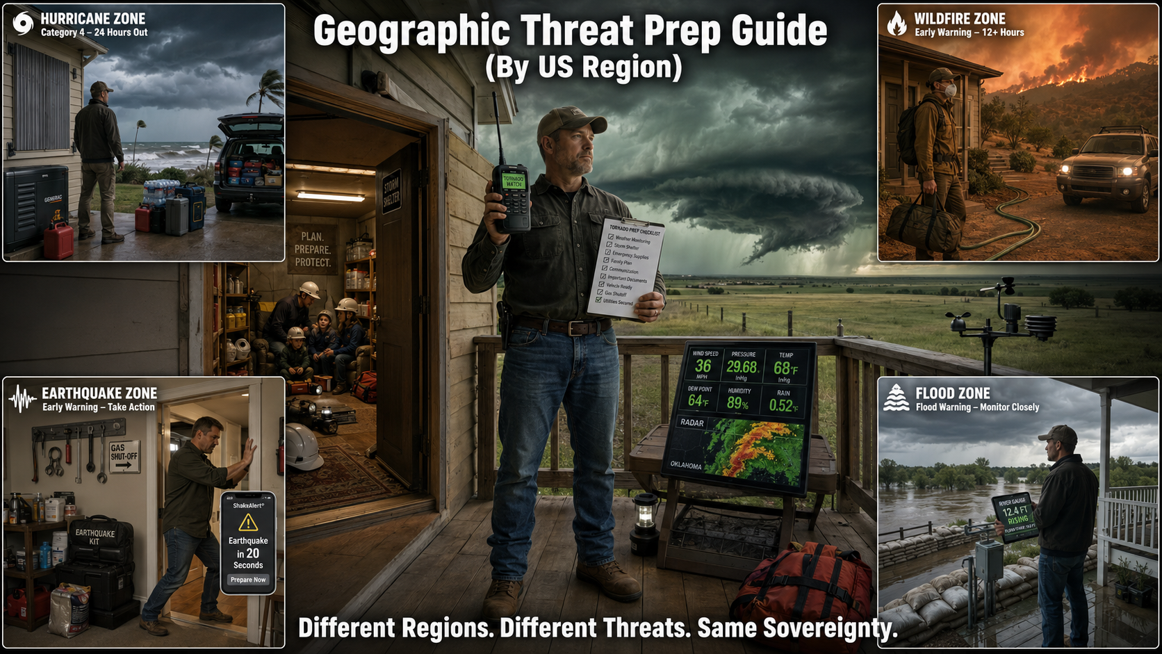
Your geographic threat prep guide isn’t about preparing for every disaster on Earth—it’s about preparing for the specific disasters that will actually hit your location. The earthquake kit that saves lives in California is worthless in Oklahoma, where tornadoes strike with 30 seconds of warning. The hurricane shutters that protect Florida homes do nothing for Montana residents facing wildfire evacuation. And the flood insurance that’s mandatory in Louisiana floodplains is a waste of money in Arizona desert.
The uncomfortable truth is that most disaster preparation advice is dangerously generic. National preparedness guides tell you to “be ready for anything,” which in practice means you’re not truly ready for the specific threat that will hit your home. When the disaster strikes—and it will strike—you’ll discover that your carefully assembled supplies, your practiced evacuation plan, and your expensive home modifications were designed for the wrong emergency.
This isn’t theoretical. During Hurricane Katrina, residents who prepared for typical hurricanes weren’t ready for catastrophic levee failure and citywide flooding. During the 2018 Camp Fire, California residents who had wildfire plans still died because they underestimated how fast fire moves in extreme wind. During the 2021 Texas freeze, millions who prepared for heat and hurricanes froze in their homes because they never considered extended grid failure in winter.
This is your complete geographic threat prep guide—from identifying your region’s specific threats to building location-tailored survival plans that actually work when disaster strikes. Because when the hurricane, tornado, earthquake, or wildfire hits your area, generic preparation kills. Specific preparation saves lives.
Why Your Geographic Threat Prep Guide Must Be Location-Specific
 Before you buy another generic disaster supply, understand why location-specific preparation is the difference between survival and catastrophe.
The Fatal Flaw of Generic Disaster Preparation
The generic advice: “Prepare for natural disasters by storing water, food, and first aid supplies.”
Why it fails:
- Doesn’t address your specific threat: Tornado victims need helmets and safe rooms, not just water
- Wrong timing assumptions: Hurricane evacuation requires 24-48 hours notice; tornadoes give 5-15 minutes
- Inappropriate supplies: Desert residents need sun protection and massive water storage; coastal residents need hurricane shutters and elevation
- Misallocated resources: Spending $5,000 on earthquake retrofitting in Kansas (no earthquake risk) instead of tornado safe room (high tornado risk)
Real consequence: You’ve spent time and money preparing for disasters that won’t happen in your area, while remaining vulnerable to the disasters that will.
How Regional Threats Differ (And Why It Matters)
Coastal vs. Inland:
- Coastal: Hurricanes, storm surge, saltwater flooding, tropical storms
- Inland: Tornadoes, river flooding, severe thunderstorms, winter storms
- Preparation difference: Coastal needs vertical evacuation plans and storm surge maps; inland needs underground shelter and rapid-response protocols
Mountain vs. Plains:
- Mountain: Avalanche, wildfire, extreme cold, landslides, limited evacuation routes
- Plains: Tornadoes, extreme heat, drought, straight-line winds, long evacuation distances
- Preparation difference: Mountain needs multiple evacuation routes and fire-resistant landscaping; plains needs storm shelter and heat survival strategies
Seismic vs. Non-Seismic:
- Seismic zones: Earthquake, tsunami (coastal), aftershocks, infrastructure collapse
- Non-seismic zones: No earthquake risk, different structural priorities
- Preparation difference: Seismic zones need structural retrofitting and earthquake supplies; non-seismic zones allocate those resources to actual regional threats
The Cost of Preparing for the Wrong Disaster
Financial cost:
- Earthquake insurance in non-seismic zones: $800-2,000/year wasted
- Hurricane shutters in tornado country: $5,000-15,000 wasted
- Flood insurance outside floodplains: $400-700/year wasted
Opportunity cost:
- Money spent on wrong preparation = money not spent on right preparation
- Time learning wrong protocols = time not learning right protocols
- Mental bandwidth on wrong threats = mental bandwidth not on real threats
Survival cost:
- False sense of security (thinking you’re prepared when you’re not)
- Wrong response during actual disaster (applying wrong protocols)
- Death or injury from inadequate preparation for actual threat
Real Survival Stories: Right Prep, Wrong Location
Story 1: The California transplant in Oklahoma
- Prepared for earthquakes (California mindset)
- Tornado hit with 8 minutes warning
- No safe room, no tornado plan
- Survived by luck (sheltered in bathtub), but unprepared
Story 2: The Florida retiree in Colorado
- Prepared for hurricanes (Florida experience)
- Wildfire evacuation order with 2 hours notice
- No go-bag, no evacuation plan, no fire-resistant landscaping
- Barely escaped, lost home
Story 3: The Midwest farmer in coastal Texas
- Prepared for tornadoes and winter storms
- Hurricane storm surge flooded home
- No elevation plan, no vertical evacuation strategy
- Rescued from roof by helicopter
The lesson: Previous experience in different regions creates dangerous false confidence. Your new location requires new preparation.
The short version: A geographic threat prep guide must be location-specific because regional disasters require different supplies, timing, and responses. Coastal regions need hurricane shutters and storm surge evacuation plans; inland regions need tornado safe rooms and rapid-response protocols; seismic zones need structural retrofitting and earthquake supplies; wildfire regions need defensible space and early evacuation plans. Generic preparation wastes resources on wrong threats while leaving you vulnerable to actual regional disasters.
Key Takeaways:
– Disaster preparedness must be geographically specific: Tailor your plans, supplies, and home protections to the primary threats in your US region for effective survival.
– Focus your resources on your top 3 regional threats: Allocate about 80% of your effort and budget to the most likely hazards, and 20% to general preparedness applicable to all disasters.
– Understand cascading and secondary hazards: Prepare not just for initial disasters (hurricanes, earthquakes, floods) but also their common aftereffects (fires, infrastructure failures, debris flows).
– Evacuation timing and planning saves lives: Know your local evacuation routes, leave early to avoid traffic or blocked roads, and have multiple exit options depending on the disaster type.
– Regularly update your geographic threat assessment: Review hazards, supplies, insurance, and plans annually or after any major event, move, or family change to stay aligned with evolving risks and climate trends.
Understanding Your Geographic Threat Profile
 Not all regions face the same dangers. Understanding your specific threat profile is the foundation of effective preparation.
Coastal Regions: Hurricane, Tsunami, and Storm Surge Threats
Atlantic Coast threat assessment (hurricanes, nor’easters)
Primary threats:
- Hurricanes: Category 1-5, June-November peak season
- Nor’easters: October-April, can be as destructive as hurricanes
- Storm surge: 10-20+ feet of water pushed inland by storms
- Coastal erosion: Long-term threat to beachfront properties
High-risk states: Florida, North Carolina, South Carolina, Georgia, Virginia, Maryland, Delaware, New Jersey, New York, Connecticut, Rhode Island, Massachusetts, New Hampshire, Maine
Specific vulnerabilities:
- Florida: Annual hurricane threat, storm surge, flooding
- North Carolina (Outer Banks): Extreme storm surge vulnerability, barrier island erosion
- New York/New Jersey: Nor’easters, hurricane remnants (Sandy 2012)
Pacific Coast threat assessment (earthquakes, tsunamis, wildfires)
Primary threats:
- Earthquakes: Cascadia Subduction Zone (magnitude 9.0+ potential), San Andreas Fault
- Tsunamis: Generated by offshore earthquakes, 15-30 minute warning
- Wildfires: Extended fire season, Santa Ana winds, drought
- Coastal erosion: Sea level rise, cliff collapse
High-risk states: California, Oregon, Washington, Alaska, Hawaii
Specific vulnerabilities:
- California: San Andreas Fault (southern CA), Cascadia (northern CA), wildfire interface
- Oregon/Washington: Cascadia Subduction Zone (overdue for magnitude 9.0+), tsunami inundation zones
- Alaska: Frequent earthquakes, tsunami risk, extreme cold
- Hawaii: Volcanic activity, tsunami risk, hurricanes
Gulf Coast threat assessment (hurricanes, flooding, heat)
Primary threats:
- Hurricanes: Category 1-5, June-November, rapid intensification over warm Gulf waters
- Storm surge: 15-25+ feet possible, flat coastal topography increases inland penetration
- Flooding: Heavy rainfall, slow-moving storms, inadequate drainage
- Extreme heat: Summer temperatures 95-105°F, high humidity
High-risk states: Texas, Louisiana, Mississippi, Alabama, Florida (Gulf side)
Specific vulnerabilities:
- Louisiana: Below sea level (New Orleans), levee dependency, subsidence
- Texas: Long coastline, oil/gas infrastructure, urban flooding (Houston)
- Florida (Gulf): Warm shallow waters intensify hurricanes, storm surge
Inland Regions: Tornado, Flood, and Severe Weather Threats
Tornado Alley preparation (Oklahoma, Kansas, Nebraska)
Primary threats:
- Tornadoes: EF0-EF5, peak season April-June, can occur year-round
- Severe thunderstorms: Large hail (baseball-sized), straight-line winds (80+ mph)
- Flash flooding: Intense rainfall, rapid water rise
- Winter storms: Ice, blizzards, extreme cold
High-risk states: Oklahoma, Kansas, Nebraska, Texas (northern), South Dakota, Iowa
Specific vulnerabilities:
- Oklahoma: Highest tornado frequency in US, EF4-EF5 tornadoes
- Kansas: Tornado Alley core, large violent tornadoes
- Moore, Oklahoma: Repeatedly hit by violent tornadoes (1999, 2013)
Tornado characteristics:
- Warning time: 5-15 minutes average (sometimes less)
- Speed: Tornadoes move 30-70 mph, winds inside 200+ mph
- Seasonality: Peak April-June, but can occur any month
Midwest flood zones (Mississippi River basin)
Primary threats:
- River flooding: Mississippi, Missouri, Ohio rivers, spring snowmelt + rainfall
- Flash flooding: Intense thunderstorms, urban flooding
- Agricultural flooding: Widespread crop damage, economic impact
High-risk states: Missouri, Illinois, Iowa, Arkansas, Tennessee, Kentucky, Indiana, Ohio
Specific vulnerabilities:
- Mississippi River: 100-year and 500-year floodplains, levee systems
- Urban areas: St. Louis, Memphis, New Orleans (covered in coastal section)
Great Plains severe weather (hail, wind, lightning)
Primary threats:
- Large hail: Golf ball to softball-sized, vehicle and roof damage
- Straight-line winds: Derechos (80-100+ mph), widespread damage
- Lightning: High frequency, wildfire ignition, direct strike danger
- Drought: Multi-year droughts, agricultural impact
Mountain Regions: Avalanche, Wildfire, and Extreme Weather
Rocky Mountain threats (avalanche, wildfire, extreme cold)
Primary threats:
- Avalanche: Winter and spring, backcountry and highway corridors
- Wildfire: Summer and fall, beetle-kill forests increase fuel load
- Extreme cold: -20°F to -40°F, wind chill -60°F
- Flash flooding: Monsoon season, burn scar flooding
High-risk states: Colorado, Wyoming, Montana, Idaho, Utah
Specific vulnerabilities:
- Colorado: I-70 corridor avalanche danger, Front Range wildfire interface
- Montana: Extreme cold, wildfire, limited evacuation routes
- Wyoming: Yellowstone volcanic risk (low probability, catastrophic impact)
Appalachian threats (flooding, ice storms, landslides)
Primary threats:
- Flooding: Mountainous terrain channels water, flash floods
- Ice storms: Freezing rain, power outages, tree damage
- Landslides: Heavy rainfall, steep slopes, unstable geology
- Severe thunderstorms: Orographic enhancement, intense rainfall
High-risk states: West Virginia, Kentucky, Tennessee, North Carolina, Virginia, Pennsylvania
Specific vulnerabilities:
- West Virginia: Coal mining subsidence, flash flooding in hollows
- North Carolina (mountains): Landslides, flooding (Tropical Storm Fred 2021)
Sierra Nevada threats (wildfire, drought, earthquake)
Primary threats:
- Wildfire: Extended fire season, drought, beetle-kill, dense forests
- Drought: Multi-year droughts, water scarcity
- Earthquake: Eastern Sierra fault systems
- Avalanche: Winter backcountry danger
High-risk areas: California Sierra Nevada, Lake Tahoe region
Desert Regions: Extreme Heat, Flash Floods, and Dust Storms
Southwest desert threats (heat, flash floods, haboobs)
Primary threats:
- Extreme heat: 110-120°F summer temperatures, heat-related deaths
- Flash floods: Monsoon season (July-September), rapid water rise in washes
- Dust storms (haboobs): Zero visibility, respiratory hazards, vehicle accidents
- Drought: Long-term water scarcity, wildfire fuel
High-risk states: Arizona, Nevada, New Mexico, California (desert regions), Utah (southern)
Specific vulnerabilities:
- Phoenix, Arizona: Urban heat island, 120°F+ temperatures, haboobs
- Las Vegas, Nevada: Extreme heat, flash flooding, water scarcity
- Death Valley, California: Hottest place on Earth (134°F record)
Water scarcity and heat survival
Critical considerations:
- Water storage: 2-3 gallons per person per day (double normal due to heat)
- Cooling strategies: Evaporative cooling, shade, night activity
- Heat illness: Heat exhaustion and heat stroke prevention
Monsoon season preparation
Monsoon characteristics:
- Season: July-September (Arizona, New Mexico)
- Flash floods: Dry washes become raging rivers in minutes
- Lightning: Intense electrical activity
- Dust storms: Precede monsoon storms, zero visibility
Seismic Zones: Earthquake Preparedness by Region
West Coast earthquake zones (San Andreas, Cascadia)
San Andreas Fault (California):
- Threat: Magnitude 7.0-8.0+ earthquake
- Affected areas: Southern California (Los Angeles, San Diego), Central California (San Francisco Bay Area)
- Probability: 75% chance of magnitude 7.0+ in next 30 years
- Secondary threats: Fire, infrastructure collapse, aftershocks
Cascadia Subduction Zone (Pacific Northwest):
- Threat: Magnitude 9.0+ megathrust earthquake
- Affected areas: Northern California, Oregon, Washington, British Columbia
- Probability: 10-15% in next 50 years (overdue, last event 1700)
- Secondary threats: Tsunami (15-30 minute warning), widespread infrastructure collapse, months-long recovery
New Madrid Seismic Zone (Midwest)
Threat profile:
- Location: Missouri, Arkansas, Tennessee, Kentucky, Illinois
- Threat: Magnitude 7.0-8.0 earthquake (last major events 1811-1812)
- Probability: 7-10% in next 50 years
- Unique vulnerability: Central US buildings not designed for earthquakes, soft soil amplifies shaking
Alaska and Hawaii seismic activity
Alaska:
- Threat: Frequent earthquakes (magnitude 7.0+ every few years)
- Recent: 2018 Anchorage magnitude 7.1
- Secondary threats: Tsunami, avalanche, infrastructure damage in extreme cold
Hawaii:
- Threat: Volcanic earthquakes, flank collapse potential
- Recent: 2018 Kilauea eruption and earthquakes
- Secondary threats: Lava flows, volcanic gases, tsunami
The Geographic Threat Assessment Framework
 A systematic approach to identifying and prioritizing your location’s specific threats.
Step 1: Identify Your Primary Threats (Top 3)
Using FEMA flood maps and hazard data
FEMA resources:
- Flood Map Service Center: msc.fema.gov (flood zones, base flood elevation)
- National Risk Index: hazards.fema.gov/nri (comprehensive hazard data by county)
- Hazus: FEMA’s risk assessment tool (earthquake, flood, hurricane loss estimates)
How to use:
- Enter your address in FEMA Flood Map Service Center
- Identify flood zone (X = minimal risk, A/V = high risk, requires flood insurance)
- Check National Risk Index for your county (shows all hazard risks and rankings)
- Note top 3 hazards by expected annual loss
Historical disaster frequency analysis
Data sources:
- NOAA Storm Events Database: ncdc.noaa.gov/stormevents (all recorded weather events by location)
- USGS Earthquake Catalog: earthquake.usgs.gov (historical earthquake data)
- National Interagency Fire Center: nifc.gov (wildfire history)
Analysis method:
- Search your county/state for last 20 years
- Count frequency of each disaster type
- Note severity (deaths, injuries, property damage)
- Identify patterns (seasonal, increasing frequency)
Example (Oklahoma County, Oklahoma):
- Tornadoes: 15 events in 20 years (including EF5 in 2013)
- Severe thunderstorms: 200+ events
- Winter storms: 30+ events
- Primary threats: Tornadoes, severe thunderstorms, winter storms
Climate change impact on regional threats
Changing threat landscape:
- Hurricanes: Increasing intensity (Category 4-5), slower movement (more rainfall)
- Wildfires: Longer fire seasons, larger fires, expanding into new regions
- Flooding: More intense rainfall events, atmospheric rivers
- Heat: More frequent and longer heat waves, expanding heat zones
- Tornadoes: Shifting patterns (Dixie Alley emergence in Southeast)
How to account for climate change:
- Review climate projections for your region (NOAA, NASA)
- Assume historical frequency is minimum (threats likely increasing)
- Prepare for threats that are emerging in your region
- Update assessment every 2-3 years
Step 2: Assess Secondary and Cascading Threats
How one disaster triggers another
Common cascading scenarios:
Hurricane → Flooding → Infrastructure failure:
- Hurricane makes landfall
- Heavy rainfall causes inland flooding
- Flooding damages water treatment, power grid
- Result: No power, no clean water for weeks
Earthquake → Fire → Structural collapse:
- Earthquake ruptures gas lines
- Gas ignites, starting fires
- Water mains broken, firefighting impossible
- Result: Widespread fire damage exceeds earthquake damage (1906 San Francisco)
Wildfire → Flash flooding → Debris flows:
- Wildfire burns vegetation on slopes
- Monsoon rains hit burn scar
- No vegetation to slow water, soil destabilized
- Result: Debris flows and flash flooding (Montecito 2018)
Drought → Wildfire → Air quality crisis:
- Multi-year drought dries vegetation
- Wildfire ignites, spreads rapidly
- Smoke travels hundreds of miles
- Result: Regional air quality emergency
Infrastructure failure scenarios
Power grid failure:
- Triggers: Hurricane, ice storm, earthquake, extreme heat (grid overload)
- Cascading effects: No water pumping, no sewage treatment, no refrigeration, no communication
- Duration: Days to weeks (or months in catastrophic scenarios)
Water system failure:
- Triggers: Earthquake (broken mains), flooding (contamination), power outage (no pumping)
- Cascading effects: No drinking water, no firefighting, no sanitation
- Duration: Days to weeks
Transportation network failure:
- Triggers: Flooding (road closures), earthquake (bridge collapse), wildfire (evacuation gridlock)
- Cascading effects: No evacuation, no supply delivery, no emergency response
- Duration: Days to months
Seasonal threat variations
Hurricane season (June-November):
- Peak: August-October
- Preparation window: May-June
- Evacuation timing: 24-48 hours before landfall
Tornado season (varies by region):
- Tornado Alley: April-June peak
- Dixie Alley: November-April peak
- Year-round possibility: Tornadoes can occur any month
Wildfire season (varies by region):
- California: May-November (peak July-October)
- Southwest: April-June (pre-monsoon), September-November (post-monsoon)
- Pacific Northwest: July-September
Flood season (varies by region):
- Spring snowmelt: March-June (mountain and northern states)
- Hurricane season: June-November (coastal states)
- Monsoon season: July-September (Southwest)
Step 3: Evaluate Your Specific Vulnerability
Home construction and location risks
Construction vulnerabilities:
- Wood frame: Vulnerable to wildfire, termites, rot
- Brick/masonry: Vulnerable to earthquake (unreinforced)
- Mobile home: Vulnerable to tornado, hurricane, earthquake
- Older construction: May not meet current building codes for regional threats
Location vulnerabilities:
- Floodplain: 100-year or 500-year flood zone
- Coastal: Storm surge zone, erosion, sea level rise
- Wildfire interface: Within 1 mile of wildland vegetation
- Fault zone: Within Alquist-Priolo Earthquake Fault Zone (California)
- Steep slope: Landslide risk, difficult evacuation
Proximity to hazard zones (floodplains, fault lines, wildfire zones)
How to check:
- Floodplain: FEMA Flood Map Service Center (msc.fema.gov)
- Fault lines: USGS Earthquake Hazards Program (earthquake.usgs.gov)
- Wildfire zones: State forestry websites, CAL FIRE (California), local fire departments
- Tsunami zones: NOAA Tsunami Inundation Maps (tsunami.noaa.gov)
Risk assessment:
- High risk: Inside hazard zone (floodplain, wildfire interface, tsunami zone)
- Moderate risk: Adjacent to hazard zone (1-2 miles)
- Low risk: Outside hazard zone (but still prepare for regional threats)
Community infrastructure resilience
Critical infrastructure assessment:
- Power grid: Above-ground lines (vulnerable to ice, wind) vs. underground (more resilient)
- Water system: Single source vs. redundant sources, backup power
- Roads: Multiple evacuation routes vs. single route (bottleneck risk)
- Emergency services: Hospital capacity, fire department response time, emergency shelters
Community preparedness:
- Warning systems: Tornado sirens, tsunami sirens, emergency alerts
- Evacuation plans: Published routes, shelter locations, special needs assistance
- Mutual aid: Neighboring jurisdictions, state/federal resources
Region-Specific Preparation Strategies
 Different threats require fundamentally different preparation approaches.
Hurricane-Prone Regions (Coastal Preparation)
Hurricane-resistant home modifications
Roof protection:
- Hurricane straps: Metal connectors securing roof to walls (prevents roof lift-off)
- Secondary water barrier: Self-adhering membrane under shingles (prevents water intrusion if shingles blow off)
- Impact-resistant shingles: Class 4 rating, wind resistance to 130+ mph
- Cost: $3,000-8,000 for average home
Window and door protection:
- Impact-resistant windows: Laminated glass, withstands debris impact
- Hurricane shutters: Accordion, roll-down, or panel systems
- Garage door bracing: Prevents garage door failure (common entry point for wind)
- Cost: $10,000-30,000 for full home (windows and doors)
Structural reinforcement:
- Wall-to-foundation anchors: Prevents house from sliding off foundation
- Gable end bracing: Strengthens vulnerable gable ends
- Soffit and eave reinforcement: Prevents wind entry
- Cost: $2,000-5,000
Elevation (if in flood zone):
- Elevate utilities: HVAC, water heater, electrical panel above base flood elevation
- Elevate entire structure: Raise house on piers or fill (expensive but effective)
- Cost: $5,000-15,000 (utilities), $50,000-150,000 (full elevation)
Evacuation routes and timing decisions
When to evacuate:
- Mandatory evacuation order: Leave immediately (legal requirement in some areas)
- Category 3+ hurricane: Evacuate if in storm surge zone or mobile home
- Category 1-2 hurricane: Evacuate if in storm surge zone, consider sheltering if in sturdy structure outside surge zone
Timing:
- Ideal: 24-48 hours before landfall (before traffic gridlock)
- Minimum: 12 hours before tropical storm force winds arrive
- Too late: Once winds reach 40+ mph (dangerous to drive)
Evacuation routes:
- Know multiple routes: Primary and alternate (in case of traffic or road closures)
- Inland direction: Perpendicular to coast (not parallel)
- Avoid low-lying roads: Flooding can occur before hurricane arrives
- Fuel up early: Gas stations run out or lose power
Storm surge survival strategies
Understanding storm surge:
- What it is: Ocean water pushed inland by hurricane winds
- Height: 10-25+ feet above normal tide (Category 3-5)
- Speed: Rises rapidly as hurricane approaches
- Danger: Drowning, structural collapse, debris impact
Survival strategies:
- Evacuate: Only safe option if in storm surge zone
- Vertical evacuation (last resort): If trapped, go to highest floor, attic, or roof
- Never shelter in single-story home in surge zone: Will be completely submerged
- Avoid enclosed attic: Bring axe or saw to cut through roof if water rises
Post-hurricane recovery preparation
Immediate needs (first 72 hours):
- Water: 1 gallon per person per day for 14 days (power outages last weeks)
- Food: Non-perishable, no cooking required (no power for stove)
- Cash: ATMs and credit card systems down
- First aid: Injuries from debris, chainsaw accidents
Extended needs (weeks to months):
- Tarps and plywood: Roof and window repairs (prevent further water damage)
- Generator and fuel: Power for refrigeration, fans, charging
- Chainsaw and safety gear: Clearing debris
- Mold prevention: Dehumidifiers, fans, bleach
Tornado-Prone Regions (Inland Preparation)
Safe room construction and requirements
What is a safe room:
- Definition: Hardened shelter designed to withstand EF5 tornado (250+ mph winds)
- FEMA standards: FEMA P-320 and P-361 (design and construction guidance)
- Protection: Debris impact, structural collapse, extreme winds
Safe room types:
Underground shelter:
- Location: In-ground, below frost line
- Construction: Reinforced concrete or steel
- Pros: Best protection, cooler in summer
- Cons: Flooding risk, accessibility (stairs), cost
- Cost: $5,000-15,000 installed
Above-ground safe room:
- Location: Interior room (closet, bathroom), no windows
- Construction: Reinforced concrete, steel, or wood with steel sheathing
- Pros: Accessible (no stairs), no flooding risk
- Cons: More expensive than underground, takes up interior space
- Cost: $7,000-20,000 installed
FEMA safe room requirements:
- Wind resistance: 250 mph (EF5 tornado)
- Debris impact: 15 lb 2×4 at 100 mph (simulates tornado debris)
- Size: 7-14 sq ft per person minimum
- Ventilation: Required for extended occupancy
- Door: Opens inward (prevents debris from blocking exit)
Early warning systems and response time
Warning systems:
- NOAA Weather Radio: Battery and hand-crank backup, SAME technology (specific area alerts)
- Wireless Emergency Alerts (WEA): Cell phone alerts, no app required
- Tornado sirens: Outdoor warning (not designed to be heard indoors)
- Weather apps: RadarScope, Weather Underground (real-time radar)
Warning timeline:
- Tornado watch: Conditions favorable for tornadoes (hours of advance notice)
- Tornado warning: Tornado detected on radar or spotted (5-15 minutes average)
- Tornado emergency: Large, violent tornado confirmed, heading toward populated area (immediate action required)
Response time:
- Average warning time: 13 minutes (2020 data)
- Best case: 20-30 minutes (slow-moving storm, good radar coverage)
- Worst case: 0-5 minutes (rapid development, radar limitations)
- Action required: Immediate movement to shelter (no time to gather supplies)
Debris survival and shelter-in-place
If no safe room:
- Best location: Interior room, lowest floor, no windows (bathroom, closet, hallway)
- Avoid: Exterior walls, windows, large rooms (gymnasiums, auditoriums)
- Mobile homes: Evacuate to sturdy structure or community shelter (mobile homes offer no protection)
Protective actions:
- Get low: Crouch or lie flat, protect head and neck
- Cover: Heavy blankets, mattress, sleeping bag (debris protection)
- Helmet: Bicycle or motorcycle helmet (head injury prevention)
- Stay put: Don’t try to outrun tornado in vehicle (tornadoes move erratically)
Post-tornado recovery
Immediate dangers:
- Downed power lines: Assume all lines are live, stay 30+ feet away
- Gas leaks: Smell of gas, hissing sound (evacuate, call 911)
- Structural instability: Collapsed walls, hanging debris (don’t enter damaged buildings)
- Injuries: Lacerations, fractures, head injuries (provide first aid, call 911)
Recovery priorities:
- Account for all family members
- Check for injuries, provide first aid
- Assess home damage (safe to enter?)
- Document damage (photos for insurance)
- Begin cleanup (wear protective gear)
Earthquake-Prone Regions (Seismic Preparation)
Structural retrofitting and bracing
Foundation bolting:
- What it is: Bolting house frame to concrete foundation
- Why: Prevents house from sliding off foundation during earthquake
- Cost: $3,000-7,000
- Required: Older homes (pre-1960s) in California
Cripple wall bracing:
- What it is: Reinforcing short walls between foundation and first floor
- Why: Prevents collapse of cripple walls (common failure point)
- Cost: $2,000-5,000
- Required: Older homes with raised foundations
Automatic gas shut-off valve:
- What it is: Valve that automatically shuts off gas when earthquake detected
- Why: Prevents gas leaks and fires (major secondary threat)
- Cost: $400-800 installed
- Recommended: All homes in seismic zones
Water heater strapping:
- What it is: Metal straps securing water heater to wall
- Why: Prevents water heater from tipping, breaking gas line
- Cost: $50-150 (DIY or professional)
- Required: California building code
Furniture and appliance anchoring:
- What to anchor: Tall furniture (bookcases, dressers), heavy appliances (refrigerator), TVs
- How: L-brackets, furniture straps, museum putty (for small items)
- Cost: $100-300 (DIY)
- Why: Prevents injuries from falling objects (leading cause of earthquake injuries)
Drop, cover, and hold on protocols
During earthquake:
- Drop: Drop to hands and knees (prevents being knocked down)
- Cover: Get under sturdy desk or table, cover head and neck
- Hold on: Hold onto shelter, move with it if it shifts
If no shelter:
- Interior wall: Crouch against interior wall, cover head and neck
- Avoid: Windows, exterior walls, doorways (not safer than other locations)
If in bed:
- Stay in bed: Cover head with pillow (less likely to be injured by broken glass)
If outdoors:
- Move away from buildings: Falling debris, glass, facades
- Drop and cover: Protect head and neck
If driving:
- Pull over: Away from overpasses, bridges, power lines, buildings
- Stay in vehicle: Provides protection from falling debris
- Don’t stop under overpass: Can collapse
Post-earthquake fire and gas leak risks
Fire risk:
- Cause: Broken gas lines, electrical shorts, overturned candles/stoves
- Prevention: Automatic gas shut-off, fire extinguisher, no open flames
- Response: Evacuate if fire starts, call 911
Gas leak risk:
- Signs: Smell of gas (rotten eggs), hissing sound
- Response: Evacuate immediately, don’t use lights/phones (spark risk), call 911 from outside
- Prevention: Automatic gas shut-off valve, know manual shut-off location
Aftershock danger:
- Frequency: Hundreds to thousands of aftershocks (decreasing over time)
- Size: Can be as large as main shock (rare but possible)
- Response: Drop, cover, hold on for each aftershock
- Building safety: Don’t enter damaged buildings (aftershocks can cause collapse)
Tsunami evacuation for coastal earthquake zones
Tsunami risk areas:
- Pacific Coast: California, Oregon, Washington, Alaska, Hawaii
- Cascadia Subduction Zone: Magnitude 9.0+ earthquake generates tsunami
Warning signs:
- Earthquake: Strong shaking lasting 20+ seconds (natural warning)
- Ocean behavior: Rapid withdrawal of water, unusual waves
- Official warning: Tsunami warning sirens, emergency alerts
Evacuation:
- Immediate: Don’t wait for official warning if you feel strong earthquake
- Direction: Inland and uphill (100+ feet elevation or 2+ miles inland)
- Speed: Tsunami arrives 15-30 minutes after earthquake (Cascadia)
- Don’t return: Multiple waves over hours, later waves can be larger
Wildfire-Prone Regions (Fire Country Preparation)
Defensible space creation (100-foot zones)
Zone 1 (0-5 feet from structure):
- Remove: All dead vegetation, leaves, needles
- Maintain: Non-combustible hardscape (gravel, pavers, concrete)
- Avoid: Mulch, wood chips, plants touching house
- Goal: No fuel for fire to reach structure
Zone 2 (5-30 feet from structure):
- Remove: Dead vegetation, ladder fuels (low branches that allow fire to climb into tree canopy)
- Maintain: Well-watered, low-growing plants, 10-foot spacing between tree canopies
- Prune: Trees 6-10 feet from ground
- Goal: Reduce fire intensity, prevent ember ignition
Zone 3 (30-100 feet from structure):
- Remove: Dead trees, heavy brush
- Maintain: Thinned trees (spacing based on slope), mowed grass
- Create: Fuel breaks (driveways, gravel paths)
- Goal: Slow fire spread, reduce ember production
Fire-resistant landscaping and materials
Fire-resistant plants:
- High moisture content: Succulents, ice plant, aloe
- Low resin/oil content: Hardwoods (oak, maple), some shrubs (rockrose, bush honeysuckle)
- Avoid: Conifers (pine, juniper, cedar), eucalyptus, ornamental grasses
Hardscape:
- Gravel, rock, pavers: Non-combustible ground cover
- Concrete, brick, stone: Pathways, patios, walls
- Metal, concrete: Fencing (avoid wood fences)
Irrigation:
- Drip irrigation: Keeps plants hydrated (fire-resistant)
- Sprinkler system: Can be used to wet down property before evacuation
Home construction materials:
Roof:
- Fire-resistant: Class A roofing (metal, tile, slate, asphalt shingles)
- Avoid: Wood shake shingles (highly combustible)
Siding:
- Fire-resistant: Stucco, fiber cement, brick, stone
- Avoid: Vinyl siding (melts), wood siding (combustible)
Vents:
- Ember-resistant vents: 1/8-inch mesh screening (prevents ember entry)
- Avoid: Large openings (embers enter attic, ignite from inside)
Windows:
- Tempered glass: Dual-pane, less likely to break from heat
- Avoid: Single-pane (breaks easily, allows ember entry)
Evacuation triggers and go-bag readiness
Evacuation triggers:
- Evacuation warning: Be ready to leave (pack vehicle, prepare pets)
- Evacuation order: Leave immediately (mandatory)
- Fire behavior: Rapid fire spread, wind shift toward your location
- Personal judgment: Don’t wait for official order if you feel unsafe
When to leave:
- Early: Before evacuation order (avoid traffic, safer conditions)
- Ideal: When evacuation warning issued (time to prepare)
- Too late: When fire is visible or smoke is heavy (dangerous driving conditions)
Go-bag contents:
- Documents: ID, insurance, property deed, medical records (waterproof container)
- Medications: 7-day supply minimum
- Clothing: 3-day supply, sturdy shoes
- Food and water: 3-day supply
- Cash: ATMs may be offline
- Phone charger: Car charger and portable battery
- Pet supplies: Food, water, leash, carrier
Air quality and smoke survival
Smoke health impacts:
- PM2.5: Fine particulate matter, penetrates deep into lungs
- Health effects: Respiratory irritation, asthma attacks, heart problems
- Vulnerable populations: Children, elderly, people with respiratory/heart conditions
Air quality index (AQI):
- 0-50 (Green): Good
- 51-100 (Yellow): Moderate
- 101-150 (Orange): Unhealthy for sensitive groups
- 151-200 (Red): Unhealthy
- 201-300 (Purple): Very unhealthy
- 301+ (Maroon): Hazardous
Protection strategies:
- Stay indoors: Close windows and doors, run AC on recirculate
- Air purifiers: HEPA filters (remove PM2.5)
- N95 masks: Properly fitted (not surgical masks, cloth masks)
- Avoid outdoor activity: Especially strenuous exercise
- Monitor AQI: AirNow.gov, PurpleAir.com
Flood-Prone Regions (Floodplain Preparation)
Elevation strategies and flood barriers
Permanent elevation:
- Elevate structure: Raise entire house on piers, pilings, or fill
- Cost: $50,000-150,000 (depending on size and method)
- Benefit: Removes from flood risk, reduces insurance premiums
- Requirement: Must be above base flood elevation (BFE) + freeboard (1-3 feet)
Elevate utilities:
- What to elevate: HVAC, water heater, electrical panel, washer/dryer
- How: Relocate to upper floor or elevate on platform
- Cost: $5,000-15,000
- Benefit: Prevents damage to expensive equipment, faster recovery
Flood barriers:
- Sandbags: Traditional method, labor-intensive, 6-12 inches high
- Flood panels: Aluminum or composite panels, fit in door/window openings
- Flood gates: Permanent installation, deploy when flood threatens
- Inflatable barriers: Water-filled tubes, quick deployment
- Cost: $500-5,000 (depending on type and coverage)
Flood vents:
- What they are: Openings in foundation walls that allow water to flow through
- Why: Prevents structural damage from hydrostatic pressure
- Requirement: Required in some flood zones (FEMA)
- Cost: $500-2,000 installed
Rapid evacuation vs. vertical evacuation
Rapid evacuation (preferred):
- When: Flood warning with hours of notice
- How: Drive to higher ground before roads flood
- Advantage: Safest option, avoids being trapped
Vertical evacuation (last resort):
- When: Trapped by rapidly rising water, no time to evacuate
- How: Move to upper floor or attic, bring supplies
- Danger: May need to cut through roof if water continues rising
- Preparation: Store axe or saw in attic, mark roof for rescue
Never:
- Drive through flooded roads: 6 inches of water can stall vehicle, 12 inches can sweep it away
- Walk through moving water: 6 inches of moving water can knock you down
- Enter flooded basement: Risk of electrocution, drowning
Waterborne disease prevention
Contamination risks:
- Sewage: Floodwater often contains raw sewage
- Chemicals: Oil, gasoline, pesticides, industrial chemicals
- Bacteria: E. coli, Salmonella, Shigella
- Viruses: Hepatitis A, Norovirus
Prevention:
- Avoid contact: Don’t wade through floodwater if possible
- Protective gear: Rubber boots, gloves, eye protection
- Wash thoroughly: Soap and clean water after any contact
- Disinfect: Bleach solution (1 cup bleach per gallon water) for surfaces
- Boil water: If water supply contaminated, boil 1 minute before drinking
Mold and contamination recovery
Mold growth:
- Timeline: Begins within 24-48 hours of flooding
- Health risks: Respiratory problems, allergic reactions, asthma
- Prevention: Dry out within 24-48 hours (fans, dehumidifiers)
Cleanup process:
- Safety first: Wear N95 mask, gloves, eye protection, rubber boots
- Remove water: Pump out, wet-vac, mop
- Remove damaged materials: Drywall, insulation, carpet (if wet >48 hours)
- Dry out: Fans, dehumidifiers, open windows (if humidity low outside)
- Disinfect: Bleach solution on all surfaces
- Monitor: Check for mold growth, musty odors
What to discard:
- Porous materials: Carpet, drywall, insulation (if wet >48 hours)
- Food: Any food contacted by floodwater
- Medications: Contaminated medications
- Cosmetics: Contaminated cosmetics
Essential Supplies by Geographic Threat
Different disasters require different supplies. Prioritize based on your region’s primary threats.
Hurricane Supplies (Coastal Regions)
Water storage (1 gallon/person/day for 14 days)
Why 14 days:
- Power outages last 1-2 weeks average (major hurricanes)
- Water treatment plants offline (no tap water)
- Stores closed or sold out
Storage:
- Commercial bottled water: Easiest, 5-year shelf life
- Water storage containers: 5-7 gallon jugs, stackable
- Bathtub bladder: 100-gallon emergency water storage (fill before hurricane)
Calculation:
- 1 person × 14 days = 14 gallons
- 4 people × 14 days = 56 gallons
Hurricane shutters and plywood
Hurricane shutters:
- Types: Accordion, roll-down, Bahama, colonial, panel
- Cost: $10-50 per square foot installed
- Benefit: Quick deployment, reusable, wind and debris protection
Plywood (budget option):
- Specification: 5/8-inch exterior-grade plywood
- Installation: Pre-cut to window sizes, label, store flat
- Fasteners: Bolts or screws (not nails), pre-drill holes
- Cost: $30-50 per window
Generator and fuel (extended power outages)
Generator sizing:
- Essential loads: Refrigerator (700W), freezer (500W), lights (300W), fans (200W)
- Recommended: 3,500-5,000W portable generator
- Cost: $500-1,500
Fuel storage:
- Gasoline: 5-gallon cans, stabilizer (extends shelf life to 12 months)
- Amount: 20-30 gallons (1 week of runtime)
- Safety: Store outside, away from house, in shade
Waterproof document storage
What to protect:
- Identification: Birth certificates, passports, Social Security cards
- Financial: Bank statements, insurance policies, property deed
- Medical: Prescriptions, medical records, insurance cards
Storage:
- Waterproof safe: Fireproof and waterproof rated
- Waterproof bags: Ziplock, vacuum-sealed
- Digital backup: Scan and store encrypted in cloud
Tornado Supplies (Tornado Alley)
NOAA weather radio (battery and hand-crank)
Why essential:
- Tornado warnings: Often issued at night (sleeping)
- Power outages: Sirens may not work, cell towers down
- SAME technology: Alerts only for your specific county
Features:
- Battery backup: AA or AAA batteries
- Hand-crank: Generates power without batteries
- Tone alert: Loud alarm wakes you up
- Cost: $30-80
Helmet and protective gear (debris protection)
Why helmets:
- Leading cause of death: Head injuries from debris
- Protection: Bicycle or motorcycle helmet
- Storage: Keep in safe room or shelter location
Additional protective gear:
- Heavy blanket or sleeping bag: Cover body, protect from debris
- Sturdy shoes: Protect feet from debris during evacuation
- Gloves: Protect hands when clearing debris
First aid for traumatic injuries
Common tornado injuries:
- Lacerations: Cuts from glass, metal, wood
- Fractures: Broken bones from falling debris, structural collapse
- Head injuries: Concussions, skull fractures
- Puncture wounds: Nails, metal, wood splinters
First aid supplies:
- Trauma kit: Tourniquets, pressure bandages, chest seals
- Gauze and bandages: Large quantities (multiple injuries)
- Splints: SAM splints, improvised splints
- Pain relief: Ibuprofen, acetaminophen
- Antibiotics: If available (prevent infection)
Flashlights and backup lighting
Why essential:
- Tornadoes often strike at night: Darkness compounds danger
- Power outages: Can last days to weeks
- Navigation: Finding shelter, assessing damage, evacuation
Lighting:
- Flashlights: LED, multiple per person
- Headlamps: Hands-free operation
- Lanterns: Area lighting for shelter
- Batteries: Stockpile extras, multiple sizes
- Hand-crank flashlight: No batteries required
Earthquake Supplies (Seismic Zones)
Earthquake straps and furniture anchors
What to anchor:
- Tall furniture: Bookcases, dressers, china cabinets
- Heavy appliances: Refrigerator, water heater
- TVs: Flat screens (tip hazard)
- Hanging items: Mirrors, pictures (use earthquake putty or wire)
Anchoring methods:
- L-brackets: Screw into wall studs and furniture
- Furniture straps: Flexible straps, easier installation
- Museum putty: Small items, decorative objects
- Cost: $100-300 (DIY)
Fire extinguisher and gas shut-off wrench
Fire extinguisher:
- Type: ABC rated (all fire types)
- Size: 5-10 lb for home
- Location: Kitchen, garage, near bedrooms
- Training: Know how to use (PASS: Pull, Aim, Squeeze, Sweep)
Gas shut-off wrench:
- What it is: Wrench that fits gas meter valve
- Location: Attached to gas meter (accessible)
- When to use: If you smell gas, hear hissing, or see damage to gas lines
- How: Turn valve 1/4 turn (perpendicular to pipe)
Heavy-duty gloves and sturdy shoes
Why essential:
- Broken glass: Windows, dishes, mirrors shatter
- Sharp debris: Metal, wood, nails
- Cleanup: Handling debris, moving rubble
Gloves:
- Type: Leather work gloves, cut-resistant
- Storage: Keep near bed, in earthquake kit
Shoes:
- Type: Sturdy boots or shoes (not sandals, slippers)
- Storage: Keep near bed (for nighttime earthquakes)
Whistle for signaling under rubble
Why essential:
- Voice fails: Shouting exhausts you, damages vocal cords
- Whistle carries farther: Can be heard by rescuers
- Conserves energy: Minimal effort to blow whistle
Storage:
- On keychain: Always with you
- In earthquake kit: Backup whistle
- Near bed: For nighttime earthquakes
Wildfire Supplies (Fire Country)
N95 masks and air purifiers
N95 masks:
- Why: Filters PM2.5 (fine particulate matter in smoke)
- Fit: Must be properly fitted (no gaps)
- Not effective: Surgical masks, cloth masks (don’t filter PM2.5)
- Quantity: 10-20 masks per person (wildfire season)
Air purifiers:
- Type: HEPA filter (removes PM2.5)
- Size: Match to room size (CADR rating)
- Placement: Bedroom (sleep in clean air)
- Cost: $150-500
Fire-resistant clothing and blankets
Fire-resistant clothing:
- Materials: Wool, cotton (natural fibers), fire-resistant synthetics
- Avoid: Polyester, nylon (melt and stick to skin)
- Coverage: Long sleeves, long pants, closed-toe shoes
Fire blankets:
- What they are: Wool or fire-resistant fabric blankets
- Use: Cover yourself if caught in fire, smother small fires
- Storage: In vehicle, go-bag
Garden hoses and sprinkler systems
Garden hoses:
- Length: Long enough to reach all sides of house
- Storage: Connected to spigot, ready to use
- Use: Wet down house, vegetation before evacuation
Sprinkler systems:
- Roof sprinklers: Wet down roof (ember protection)
- Perimeter sprinklers: Wet down defensible space
- Activation: Turn on before evacuation (if time allows)
Go-bag with 72-hour supplies
Go-bag contents:
- Documents: Waterproof container (ID, insurance, deed, medical records)
- Medications: 7-day supply minimum
- Clothing: 3-day supply, fire-resistant if possible
- Food and water: 3-day supply, no cooking required
- Cash: $200-500 (ATMs offline)
- Phone charger: Car charger, portable battery
- Flashlight and batteries
- First aid kit
- Pet supplies: Food, water, leash, carrier, medications
Storage:
- Accessible location: Near exit, easy to grab
- Vehicle: Keep in vehicle during fire season (ready to go)
Flood Supplies (Floodplains)
Life jackets and flotation devices
Why essential:
- Rapid water rise: May need to evacuate through water
- Vehicle flooding: Car stalls in water, need to exit
- Rescue: Waiting for rescue in floodwater
Quantity:
- One per person: Including children (child-sized)
- Type: USCG-approved life jackets (Type II or III)
- Storage: Accessible location (not in basement)
Sandbags and flood barriers
Sandbags:
- Use: Create barriers around doors, vents, garage
- Quantity: 100-200 for average home
- Filling: 1/2 to 2/3 full (allows stacking)
- Placement: Pyramid shape, stagger seams
- Limitation: Only effective for 6-12 inches of water
Flood barriers (modern alternative):
- Types: Inflatable, water-filled, aluminum panels
- Advantage: Reusable, easier to deploy, higher protection
- Cost: $500-5,000
Water purification (contamination risk)
Why essential:
- Tap water contamination: Floodwater enters water treatment plants
- Boil water orders: Common after floods
- Well contamination: Private wells flooded
Purification methods:
- Boiling: 1 minute rolling boil (most reliable)
- Water filter: 0.1-micron filter (removes bacteria, parasites)
- Chemical treatment: Bleach (8 drops per gallon, wait 30 minutes)
- UV purification: SteriPEN (kills bacteria, viruses)
Mold prevention and cleanup supplies
Prevention supplies:
- Fans: High-velocity fans (dry out quickly)
- Dehumidifiers: Remove moisture from air
- Moisture meter: Measure dryness of materials
Cleanup supplies:
- N95 masks: Protect from mold spores
- Gloves: Rubber gloves (protect from contamination)
- Bleach: Disinfect surfaces (1 cup per gallon water)
- Trash bags: Heavy-duty (dispose of damaged materials)
- Protective clothing: Long sleeves, pants, boots
Geographic-Specific Evacuation Planning
Knowing when and how to evacuateis as important as having supplies.
When to Evacuate vs. Shelter in Place (By Threat)
Hurricane: Evacuate for Category 3+ or storm surge zones
Evacuate if:
- Category 3+ hurricane: Winds 111+ mph, catastrophic damage
- Storm surge zone: Any category hurricane (drowning risk)
- Mobile home: Any hurricane (no structural protection)
- Evacuation order: Mandatory or voluntary
Shelter in place if:
- Category 1-2 hurricane: Winds 74-110 mph, outside storm surge zone
- Sturdy structure: Concrete block, reinforced, hurricane-resistant
- Supplies: 14 days of water, food, medications
Tornado: Shelter in place (no time to evacuate)
Always shelter in place:
- Warning time: 5-15 minutes average (not enough time to evacuate)
- Tornado movement: Erratic, unpredictable (can’t outrun)
- Vehicle danger: Tornadoes can lift and throw vehicles
Shelter location:
- Safe room: Underground or interior room
- Interior room: Lowest floor, no windows (bathroom, closet)
- Never: Vehicle, mobile home, exterior rooms
Earthquake: Shelter in place, then assess
During earthquake:
- Shelter in place: Drop, cover, hold on
- Don’t evacuate: Falling debris, broken glass outside
After earthquake:
- Assess damage: Structural damage, gas leaks, fire
- Evacuate if: Gas leak, fire, structural collapse risk, tsunami warning (coastal)
- Shelter in place if: Building is safe, no immediate threats
Wildfire: Evacuate early (don’t wait for orders)
Evacuate if:
- Evacuation warning or order: Leave immediately
- Fire visible: Smoke, flames, ash falling
- Personal judgment: Feel unsafe, fire behavior concerning
Timing:
- Early evacuation: Before official order (safest, avoid traffic)
- Don’t wait: Fire can move faster than you can drive (especially in wind)
Never:
- Wait for perfect information: Err on side of early evacuation
- Assume firefighters will save your home: They prioritize lives, not property
Flood: Evacuate if in floodplain, vertical evacuation if trapped
Evacuate if:
- Flood warning: Hours of notice, rising water
- Floodplain resident: 100-year or 500-year flood zone
- Flash flood warning: Immediate threat, rapid water rise
Vertical evacuation (last resort):
- When: Trapped by rapidly rising water, roads flooded
- How: Move to upper floor, attic, roof
- Preparation: Axe in attic (cut through roof if needed)
Never:
- Drive through flooded roads: Turn around, don’t drown
- Walk through moving water: 6 inches can knock you down
Regional Evacuation Routes and Timing
Coastal evacuation (contra-flow and traffic patterns)
Contra-flow:
- What it is: Reversing inbound lanes to outbound (doubles capacity)
- When activated: Major hurricanes, mass evacuations
- States using: Florida, Georgia, South Carolina, Louisiana, Texas
Traffic patterns:
- Gridlock: Expect heavy traffic, 2-4x normal travel time
- Timing: Evacuate 24-48 hours before landfall (before gridlock)
- Fuel: Gas stations run out, fill up early
Evacuation routes:
- Know multiple routes: Primary and alternate
- Inland direction: Perpendicular to coast (not parallel)
- Avoid: Low-lying roads (flood before hurricane arrives)
Wildfire evacuation (multiple routes, early departure)
Multiple routes:
- Why: Fire can block primary route
- Plan: 2-3 evacuation routes from your area
- Practice: Drive routes, know landmarks
Early departure:
- Why: Fire moves fast (especially in wind), roads become impassable
- When: Evacuation warning (don’t wait for order)
- Traffic: Expect gridlock, one-lane mountain roads
Visibility:
- Smoke: Can reduce visibility to zero
- Headlights: Use headlights, drive slowly
- Pull over: If visibility too poor, pull over, stay in vehicle
Flood evacuation (avoid low-lying roads)
Route planning:
- Avoid: Low-lying roads, areas near rivers/streams
- Use: Higher elevation routes
- Check: Road closure information (511, local emergency management)
Timing:
- Early: Before roads flood (may have hours of warning)
- Flash floods: Immediate evacuation (minutes of warning)
Never:
- Drive through water: Turn around, don’t drown (6 inches can stall vehicle)
Destination Planning by Region
Inland evacuation for coastal threats
Hurricane evacuation:
- Distance: 50-100+ miles inland (beyond storm surge and wind threat)
- Destination: Friends/family, hotel, public shelter
- Reservation: Book hotel early (sell out quickly)
Tsunami evacuation:
- Distance: 2+ miles inland or 100+ feet elevation
- Timing: 15-30 minutes after earthquake (Cascadia)
- Destination: High ground, designated tsunami evacuation zones
Out-of-state evacuation for widespread disasters
When necessary:
- Major hurricane: Category 4-5, widespread impact
- Catastrophic earthquake: Magnitude 8.0+, infrastructure collapse
- Megafire: Regional fire complex, air quality emergency
Planning:
- Destination: Out-of-state friends/family, hotel
- Distance: 200-500+ miles (beyond disaster impact zone)
- Supplies: Full tank of gas, cash, 3-day supplies in vehicle
Vertical evacuation (upper floors) for rapid-onset floods
When used:
- Trapped by rapidly rising water: No time to evacuate horizontally
- Flash floods: Minutes of warning, roads already flooded
How:
- Move to upper floor: Second floor, attic, roof
- Bring supplies: Water, food, phone, flashlight, whistle
- Signal for rescue: Bright clothing, flashlight, whistle
- Roof access: Axe or saw in attic (cut through if water rises)
Danger:
- Structural collapse: Building may not withstand floodwater pressure
- Hypothermia: Cold water, extended exposure
- Rescue delay: May wait hours or days for rescue
Home Hardening by Geographic Threat
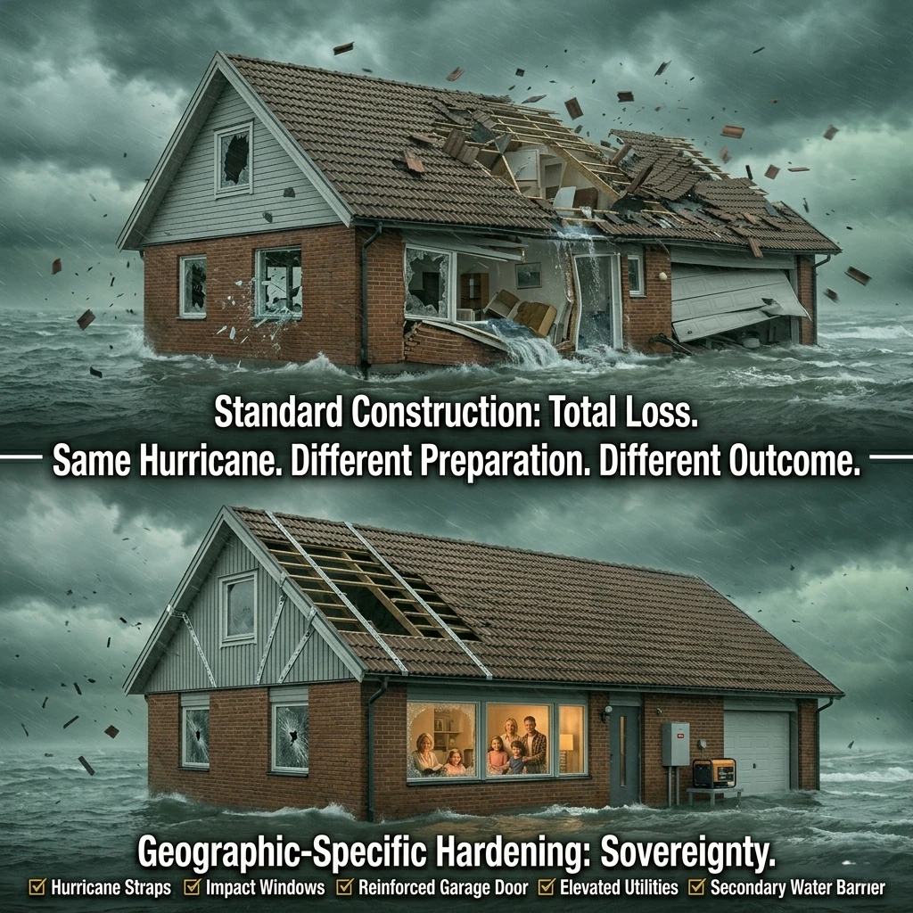 Structural modifications tailored to your region’s primary threat provide the best protection.
Hurricane-Resistant Home Modifications
Impact-resistant windows and doors
Impact-resistant windows:
- Construction: Laminated glass (two panes with plastic interlayer)
- Protection: Withstands debris impact, doesn’t shatter
- Wind resistance: Rated for 130-200+ mph winds
- Cost: $40-55 per square foot installed
- Benefit: No shutters needed, year-round protection, insurance discounts
Impact-resistant doors:
- Entry doors: Reinforced frame, multi-point locking, impact-resistant glass
- Garage doors: Reinforced, wind-rated, bracing system
- Cost: $1,500-5,000 per door
Roof strapping and reinforcement
Hurricane straps:
- What they are: Metal connectors securing roof trusses to walls
- Why: Prevents roof from lifting off in high winds
- Installation: Retrofit (existing homes) or new construction
- Cost: $3,000-8,000 for average home
Roof-to-wall connection:
- Toe-nail connection: Weakest (nails only)
- Hurricane clips: Stronger (metal clips)
- Hurricane straps: Strongest (metal straps wrapping truss)
Secondary water barrier:
- What it is: Self-adhering membrane under shingles
- Why: Prevents water intrusion if shingles blow off
- Cost: $500-1,500 (during re-roofing)
Garage door bracing
Why critical:
- Weakest point: Garage doors often fail first
- Consequence: Wind enters garage, pressurizes house, blows off roof
Bracing options:
- Horizontal bracing: Aluminum or steel bars across door
- Vertical bracing: Posts supporting door from inside
- Permanent bracing: Installed year-round
- Temporary bracing: Installed before hurricane
- Cost: $200-800
Elevated utilities and HVAC
Why elevate:
- Flood risk: Storm surge, heavy rainfall
- Damage prevention: Expensive equipment (HVAC, water heater, electrical panel)
What to elevate:
- HVAC: Outdoor unit on elevated platform or roof
- Water heater: Upper floor or elevated platform
- Electrical panel: Above base flood elevation
- Washer/dryer: Upper floor (if possible)
Cost: $5,000-15,000
Earthquake-Resistant Retrofitting
Foundation bolting and cripple wall bracing
Foundation bolting:
- What it is: Bolting wood frame to concrete foundation
- Why: Prevents house from sliding off foundation during earthquake
- When required: Older homes (pre-1960s) in California
- Cost: $3,000-7,000
- Benefit: Reduces earthquake damage by 50-70%
Cripple wall bracing:
- What it is: Short walls between foundation and first floor
- Why vulnerable: Collapse during earthquake (common failure)
- Bracing: Plywood sheathing, structural screws
- Cost: $2,000-5,000
Automatic gas shut-off valves
Why essential:
- Fire risk: Broken gas lines ignite (major secondary threat)
- Prevention: Automatic valve shuts off gas when earthquake detected
Types:
- Seismic shut-off valve: Detects ground motion, closes valve
- Excess flow valve: Detects high gas flow (broken line), closes valve
Cost: $400-800 installed
Flexible utility connections
Why needed:
- Rigid connections: Break during earthquake (gas, water, electrical)
- Flexible connections: Bend without breaking
What to install:
- Gas: Flexible gas connectors (corrugated stainless steel)
- Water: Flexible water heater connectors
- Electrical: Flexible conduit (if required by code)
Cost: $200-500
Chimney reinforcement
Why vulnerable:
- Unreinforced masonry: Collapses during earthquake
- Danger: Falls through roof, crushes occupants
Reinforcement:
- Rebar and grout: Reinforce from inside
- External bracing: Metal straps
- Rebuild: Replace with reinforced chimney or remove
Cost: $3,000-10,000
Wildfire-Resistant Construction
Non-combustible roofing (metal, tile, slate)
Class A roofing (best):
- Metal: Steel, aluminum (non-combustible, ember-resistant)
- Tile: Clay, concrete (non-combustible, heavy)
- Slate: Natural stone (non-combustible, expensive)
Avoid:
- Wood shake shingles: Highly combustible, ember ignition
- Asphalt shingles: Combustible (but better than wood)
Cost:
- Metal: $7-12 per square foot installed
- Tile: $10-18 per square foot installed
- Slate: $15-30 per square foot installed
Ember-resistant vents and eaves
Why critical:
- Ember entry: Embers enter attic through vents, ignite from inside
- Common failure: House burns from inside out
Ember-resistant vents:
- 1/8-inch mesh screening: Blocks embers, allows airflow
- Corrosion-resistant: Stainless steel, aluminum
Eave protection:
- Enclosed eaves: No gaps for ember entry
- Soffit vents: Ember-resistant vents only
Cost: $500-2,000
Tempered glass windows
Why needed:
- Radiant heat: Breaks standard glass, allows ember entry
- Tempered glass: Stronger, heat-resistant
Best:
- Dual-pane tempered glass: Best heat resistance
- Multi-pane: Even better (expensive)
Cost: $40-60 per square foot (replacement)
Fire-resistant siding materials
Best options:
- Stucco: Non-combustible, traditional in fire country
- Fiber cement: Non-combustible, looks like wood
- Brick/stone: Non-combustible, expensive
Avoid:
- Vinyl siding: Melts, ignites
- Wood siding: Combustible
Cost:
- Stucco: $6-9 per square foot installed
- Fiber cement: $8-12 per square foot installed
Flood-Resistant Elevation and Barriers
Elevated foundation (above base flood elevation)
Base flood elevation (BFE):
- What it is: Water level of 100-year flood
- Requirement: New construction must be above BFE
- Freeboard: Additional elevation above BFE (1-3 feet recommended)
Elevation methods:
- Piers/pilings: Elevate house on posts
- Fill: Raise ground level, build on top
- Crawl space: Elevated foundation with vented crawl space
Cost: $50,000-150,000 (existing home)
Flood vents and breakaway walls
Flood vents:
- What they are: Openings in foundation walls
- Why: Allow water to flow through (prevents structural damage from pressure)
- Requirement: Required in some flood zones (FEMA)
- Size: 1 square inch per square foot of enclosed area
Breakaway walls:
- What they are: Walls designed to collapse under flood pressure
- Why: Prevents structural damage to main house
- Use: Enclosed areas below BFE (garages, storage)
Cost: $500-2,000 (flood vents)
Sump pumps and backflow preventers
Sump pump:
- What it is: Pump that removes water from basement/crawl space
- Why: Prevents flooding from groundwater, heavy rain
- Backup: Battery backup (power outages during floods)
Backflow preventer:
- What it is: Valve that prevents sewage from backing up into house
- Why: Sewer systems overflow during floods
- Installation: On main sewer line
Cost: $500-2,000 (sump pump), $500-1,500 (backflow preventer)
Waterproof barriers and sealants
Waterproofing:
- Exterior walls: Waterproof coating, drainage system
- Basement: Interior/exterior waterproofing, sump pump
- Doors/windows: Seals, gaskets, flood barriers
Sealants:
- Cracks: Hydraulic cement, epoxy
- Penetrations: Seal around pipes, wires
Cost: $3,000-10,000 (full basement waterproofing)
Insurance and Financial Protection by Region
The right insurance is as important as physical preparation.
Flood Insurance (National Flood Insurance Program)
Who needs flood insurance (floodplain residents)
Required:
- Mortgage in flood zone: Lenders require flood insurance (A, V zones)
- Federal disaster assistance: Must have flood insurance to receive aid (if in flood zone)
Recommended:
- Near flood zone: Even if not in mapped zone (25% of claims outside flood zones)
- Basement: Groundwater flooding risk
- Low-lying areas: Flash flood risk
Coverage limits and exclusions
Coverage:
- Building: Up to $250,000
- Contents: Up to $100,000 (separate policy)
Exclusions:
- Basement contents: Limited coverage (washers, dryers, furnaces only)
- Landscaping: Not covered
- Swimming pools: Not covered
- Temporary housing: Not covered (unlike homeowners insurance)
30-day waiting period (buy before disaster)
Critical timing:
- Waiting period: 30 days from purchase to coverage begins
- Exception: Home purchase or loan requirement (coverage begins immediately)
Implication:
- Buy early: Can’t buy during hurricane watch/warning
- Annual renewal: Don’t let policy lapse (30-day wait to reinstate)
Cost: $400-2,000/year (depending on flood zone and coverage)
Earthquake Insurance (Seismic Zones)
Standard homeowners doesn’t cover earthquakes
Critical gap:
- Homeowners insurance: Excludes earthquake damage
- Earthquake insurance: Separate policy required
Who needs:
- California: High earthquake risk (San Andreas, Cascadia)
- Pacific Northwest: Cascadia Subduction Zone
- Other seismic zones: New Madrid (Midwest), Alaska
California Earthquake Authority (CEA)
What it is:
- State-run program: Provides earthquake insurance in California
- Participation: Most insurers participate
Coverage:
- Dwelling: Repair or rebuild
- Personal property: Contents coverage
- Additional living expenses: Temporary housing
Deductibles and coverage options
Deductibles:
- High deductibles: 10-25% of coverage amount (vs. 1-2% for homeowners)
- Example: $500,000 home, 15% deductible = $75,000 out-of-pocket before insurance pays
Why high deductibles:
- Catastrophic coverage: Designed for major earthquakes, not minor damage
- Affordability: Lower premiums with higher deductibles
Cost: $800-3,000/year (California, depending on location and deductible)
Hurricane and Windstorm Insurance
Wind deductibles in coastal states
Separate wind deductible:
- What it is: Higher deductible for wind damage (vs. other perils)
- Amount: 1-10% of coverage amount (vs. flat $500-2,000 for other perils)
- Example: $300,000 home, 5% wind deductible = $15,000 out-of-pocket
States with wind deductibles:
- Coastal states: Florida, Texas, Louisiana, North Carolina, South Carolina, etc.
- Trigger: Hurricane or named storm
Separate windstorm policies (some states)
Wind-only policies:
- What they are: Separate policy for wind damage (not included in homeowners)
- States: Florida (Citizens Property Insurance), Texas (TWIA), Louisiana (Louisiana Citizens)
Why separate:
- High risk: Coastal areas, frequent hurricanes
- Insurer withdrawal: Private insurers exit high-risk markets
- State programs: Fill coverage gap
Proof of mitigation (discounts for hardening)
Mitigation discounts:
- Hurricane shutters: 10-30% discount
- Impact-resistant windows: 10-30% discount
- Roof strapping: 10-20% discount
- Fortified home: 30-50% discount (IBHS Fortified program)
Documentation:
- Inspection: Certified inspector verifies mitigation
- Photos: Before/after photos of improvements
- Receipts: Proof of installation
Savings: Can offset cost of mitigation over 5-10 years
Community and Regional Resources
You’re not alone. Regional resources provide critical support during disasters.
Local Emergency Management Agencies
County and city emergency operations centers
What they do:
- Coordinate response: Fire, police, EMS, public works
- Issue warnings: Evacuation orders, shelter-in-place
- Operate shelters: Public emergency shelters
- Provide information: Press conferences, social media, websites
How to connect:
- Find your agency: Search “[your county] emergency management”
- Sign up for alerts: Emergency notification systems (text, email, phone)
- Follow on social media: Real-time updates during disasters
Community warning systems (sirens, alerts)
Tornado sirens:
- Coverage: Outdoor warning (not designed to be heard indoors)
- Activation: Tornado warning issued for area
- Limitation: Power outages, mechanical failure
Tsunami sirens:
- Coverage: Coastal areas, tsunami inundation zones
- Activation: Tsunami warning issued
- Sound: Distinct wailing tone
Wireless Emergency Alerts (WEA):
- What they are: Cell phone alerts (no app required)
- Types: Tornado warnings, flash flood warnings, evacuation orders
- Limitation: Requires cell service
Evacuation assistance programs
Who qualifies:
- Elderly: Limited mobility, no transportation
- Disabled: Wheelchair users, medical equipment dependent
- No vehicle: No access to transportation
Services:
- Transportation: Buses, vans to evacuation shelters
- Medical support: Ambulances for medically fragile
- Special needs shelters: Medical equipment, staff
How to register:
- Local emergency management: Pre-register before disaster
- 211: Dial 211 for information and registration
Regional Mutual Aid Networks
Neighborhood preparedness groups
What they are:
- Neighbors helping neighbors: Mutual aid, resource sharing
- Skills and resources: Pool skills, tools, supplies
- Communication: Check on each other, share information
How to start:
- Organize meeting: Invite neighbors, discuss preparedness
- Identify skills: Who has medical training, tools, generator?
- Create plan: Communication, meeting location, resource sharing
- Practice: Annual drills, test communication
Community Emergency Response Teams (CERT)
What is CERT:
- FEMA program: Free training in disaster response
- Skills taught: Fire safety, light search and rescue, medical operations, disaster psychology
- Duration: 20-hour course (evenings or weekends)
Benefits:
- Training: Professional disaster response skills
- Network: Connect with other prepared community members
- Credibility: Recognized by emergency management
How to join:
- Find local program: Search “[your city] CERT”
- Register: Free or low-cost
- Complete training: Attend all sessions, pass final exercise
Amateur radio networks (ARES, RACES)
Why amateur radio:
- Communication: When phones, internet, power fail
- Range: Local to worldwide (depending on equipment)
- Emergency use: Coordinate response, request assistance
ARES (Amateur Radio Emergency Service):
- What it is: Volunteer organization, provides emergency communication
- Activation: During disasters, supports emergency management
RACES (Radio Amateur Civil Emergency Service):
- What it is: Government program, civil defense communication
- Activation: Government-declared emergencies
How to participate:
- Get licensed: FCC amateur radio license (Technician class minimum)
- Join local group: ARES or RACES in your area
- Train: Regular drills, exercises
Common Geographic Threat Prep Mistakes
These mistakes cost lives. Learn from others’ failures.
Preparing for National Threats Instead of Local Threats
The mistake: Buying generic disaster supplies without considering regional threats
Example:
- Oklahoma resident: Buys earthquake supplies (low risk), no tornado safe room (high risk)
- Arizona resident: Buys snow gear (rare), inadequate water storage (critical)
- Florida resident: Buys wildfire supplies (low risk), no hurricane shutters (high risk)
Why it happens:
- National media: Focuses on dramatic disasters (earthquakes, wildfires)
- Generic advice: “Be prepared for anything” (not specific to location)
- Lack of research: Don’t know local threats
The fix:
- Research local threats: FEMA National Risk Index, historical data
- Prioritize: Top 3 threats for your location
- Allocate resources: 80% to top threats, 20% to secondary threats
Ignoring Secondary and Cascading Disasters
The mistake: Preparing for primary threat, ignoring secondary threats
Examples:
- Hurricane → Flooding: Prepared for wind, not flooding (leading cause of death)
- Earthquake → Fire: Prepared for shaking, not fire (1906 San Francisco: fire caused more damage than earthquake)
- Wildfire → Flash flooding: Prepared for fire, not post-fire debris flows (Montecito 2018)
Why it happens:
- Focus on primary threat: Don’t think beyond initial disaster
- Lack of knowledge: Don’t understand cascading effects
The fix:
- Research cascading threats: What happens after primary disaster?
- Prepare for secondary threats: Supplies, plans, training
- Example: Hurricane prep includes flooding supplies, not just wind protection
Underestimating Evacuation Time Requirements
The mistake: Waiting too long to evacuate, getting trapped
Examples:
- Hurricane: Waiting for mandatory evacuation order (traffic gridlock, too late)
- Wildfire: Waiting to see flames (fire moves faster than you can drive)
- Flood: Driving through flooded roads (vehicle swept away)
Why it happens:
- Normalcy bias: “It won’t be that bad”
- Attachment to home: Don’t want to leave
- Underestimate traffic: Don’t account for gridlock
The fix:
- Evacuate early: Before official order (avoid traffic)
- Know evacuation time: Practice route, account for traffic (2-4x normal)
- Set triggers: Personal evacuation triggers (don’t wait for government)
Inadequate Insurance Coverage for Regional Risks
The mistake: Assuming homeowners insurance covers regional threats
Examples:
- Flood: Homeowners doesn’t cover flooding (separate flood insurance required)
- Earthquake: Homeowners doesn’t cover earthquake (separate earthquake insurance required)
- Wind (coastal): High wind deductibles (1-10% of coverage, not flat $500-2,000)
Why it happens:
- Assumption: “I have homeowners insurance, I’m covered”
- Don’t read policy: Exclusions buried in fine print
- Cost: Additional insurance is expensive, skip it
The fix:
- Review policy: Know what’s covered and excluded
- Buy regional insurance: Flood (floodplains), earthquake (seismic zones), wind (coastal)
- Calculate risk: Cost of insurance vs. cost of total loss
Failing to Update Prep as Threats Evolve
The mistake: Preparing once, never updating as threats change
Examples:
- Climate change: Threats intensifying (stronger hurricanes, larger wildfires)
- New threats: Tornadoes in Southeast (Dixie Alley), heat waves in Pacific Northwest
- Moved to new region: Old prep doesn’t match new threats
Why it happens:
- Complacency: “I’m prepared, I’m done”
- Lack of awareness: Don’t monitor changing threats
- Effort: Updating requires time and money
The fix:
- Annual review: Update threat assessment, supplies, plans
- Monitor trends: Climate change, regional forecasts
- Adapt: Adjust prep as threats evolve
The Questions You’re Probably Asking Yourself
How do I know which disasters threaten my specific location?
Step 1: Use FEMA’s National Risk Index
- Go to hazards.fema.gov/nri
- Enter your address or county
- View all hazards ranked by expected annual loss
- Result: Comprehensive list of threats specific to your location
Step 2: Check historical disaster data
- NOAA Storm Events Database: ncdc.noaa.gov/stormevents (weather events)
- USGS Earthquake Catalog: earthquake.usgs.gov (earthquakes)
- National Interagency Fire Center: nifc.gov (wildfires)
- Search: Your county/state for last 20 years
- Result: Frequency and severity of past disasters
Step 3: Review flood and hazard maps
- FEMA Flood Map Service Center: msc.fema.gov (flood zones)
- USGS Earthquake Hazards: earthquake.usgs.gov (fault lines, seismic zones)
- State forestry websites: Wildfire hazard zones
- Result: Visual representation of hazard zones
Step 4: Consult local emergency management
- Find your agency: Search “[your county] emergency management”
- Ask: “What are the top 3 threats to our area?”
- Result: Local expert knowledge, community-specific threats
Bottom line: Use multiple data sources (FEMA, NOAA, USGS, local agencies) to identify your top 3 threats. These are your preparation priorities.
Should I prepare for all disasters or focus on the most likely?
Focus on the most likely (80/20 rule):
- 80% of resources: Top 3 threats for your location
- 20% of resources: General preparedness (applies to all disasters)
Why focus:
- Limited resources: Time, money, space are finite
- Effectiveness: Specific preparation is more effective than generic
- Likelihood: Most likely threats are most likely to occur (by definition)
Example (Oklahoma resident):
- Top 3 threats: Tornadoes, severe thunderstorms, winter storms
- 80% of prep: Tornado safe room, NOAA weather radio, winter supplies
- 20% of prep: General supplies (water, food, first aid)
- Don’t prioritize: Earthquake supplies (low risk), hurricane supplies (no risk)
General preparedness (20%):
- Water: 1 gallon/person/day for 14 days (applies to all disasters)
- Food: 30-day supply (applies to all disasters)
- First aid: Comprehensive kit (applies to all disasters)
- Communication: Battery radio, backup phone charging (applies to all disasters)
Bottom line: Focus 80% of effort on your top 3 regional threats, 20% on general preparedness that applies to all disasters. Don’t waste resources on threats that won’t happen in your area.
How often should I update my geographic threat assessment?
Minimum: Annually
- When: January (start of year) or before disaster season
- What to review: Threat data, supplies, plans, training
- Why: Threats evolve, supplies expire, skills fade
Additional triggers for updates:
After major disaster in your region:
- Why: Learn from recent event, identify gaps
- Example: After hurricane, review evacuation plan, supplies, home hardening
When moving to new location:
- Why: New location = new threats
- What to do: Complete new threat assessment, adjust prep
When climate data updates:
- Why: Climate change alters threat landscape
- What to monitor: NOAA climate forecasts, regional projections
- Example: Wildfire season expanding, prepare earlier
When family situation changes:
- Why: New family members, medical conditions, pets
- What to update: Supplies (more people), medications, pet evacuation
Annual review checklist:
- Review threat data: FEMA National Risk Index, NOAA, USGS (any changes?)
- Check supplies: Expiration dates, functionality, quantities
- Update plans: Evacuation routes, contact information, meeting locations
- Practice: Evacuation drill, shelter-in-place drill, communication test
- Adjust: Based on what you learned, update prep
Bottom line: Update annually minimum, plus after major disasters, moves, or significant changes. Preparation is not “set it and forget it”—it requires ongoing maintenance.
What if I live in a region with multiple major threats?
This is common—most regions have 2-3 major threats.
Examples:
- Gulf Coast: Hurricanes, flooding, extreme heat
- California: Earthquakes, wildfires, drought
- Midwest: Tornadoes, flooding, winter storms
- Pacific Northwest: Earthquakes, tsunamis, wildfires
Strategy: Layered preparation
Step 1: Identify overlapping needs
- Water: All disasters require water storage
- Food: All disasters require food storage
- First aid: All disasters require medical supplies
- Communication: All disasters require backup communication
Step 2: Prepare for overlaps first
- 80% of prep is the same: Water, food, first aid, communication, cash
- Focus here first: Build foundation that applies to all threats
Step 3: Add threat-specific items
- Hurricane: Shutters, generator, 14-day water supply
- Tornado: Safe room, helmet, NOAA radio
- Earthquake: Structural retrofitting, gas shut-off, furniture anchors
- Wildfire: Defensible space, N95 masks, go-bag
Step 4: Prioritize by likelihood and impact
- Most likely + highest impact: Prepare first
- Example (Gulf Coast): Hurricanes (most likely, highest impact) → prepare first; flooding (secondary threat) → prepare second; heat (ongoing threat) → prepare third
Resource allocation example (Gulf Coast, $10,000 budget):
- General prep (40%): $4,000 (water, food, first aid, communication)
- Hurricane prep (40%): $4,000 (shutters, generator, supplies)
- Flood prep (15%): $1,500 (elevation, flood insurance, barriers)
- Heat prep (5%): $500 (cooling supplies, extra water)
Bottom line: Most regions have multiple threats. Prepare for overlapping needs first (water, food, first aid), then add threat-specific items prioritized by likelihood and impact. You don’t need separate preps for each threat—80% of preparation applies to all disasters.
How does climate change affect my regional disaster risks?
Climate change is altering every region’s threat profile.
Key changes by threat type:
Hurricanes (coastal regions):
- Increasing intensity: More Category 4-5 hurricanes
- Slower movement: More rainfall, worse flooding (Harvey 2017)
- Rapid intensification: Less warning time (Michael 2018)
- Preparation impact: Need higher wind protection, more water storage, earlier evacuation
Wildfires (western states, expanding):
- Longer fire season: Year-round in some areas (was seasonal)
- Larger fires: Megafires (100,000+ acres) increasingly common
- New regions: Fires in areas that historically didn’t burn
- Preparation impact: Year-round readiness, enhanced defensible space, air quality supplies
Flooding (all regions):
- More intense rainfall: Atmospheric rivers, extreme precipitation events
- Flash flooding: Rapid-onset flooding in new areas
- Coastal flooding: Sea level rise, storm surge
- Preparation impact: Flood insurance even outside mapped zones, elevation strategies
Heat waves (expanding northward):
- Hotter temperatures: Record-breaking heat in new regions
- Longer duration: Multi-week heat waves
- New regions: Pacific Northwest, Northeast seeing extreme heat
- Preparation impact: Cooling strategies, heat illness awareness
Tornadoes (shifting patterns):
- Dixie Alley: More tornadoes in Southeast (Alabama, Mississippi, Tennessee)
- Seasonal shift: More winter/spring tornadoes
- Nighttime tornadoes: More dangerous (people sleeping)
- Preparation impact: Southeast residents need tornado prep (wasn’t priority before)
What to do:
- Monitor regional climate forecasts: NOAA Climate.gov, state climate offices
- Assume historical data is minimum: Threats likely increasing, not stable
- Prepare for emerging threats: New disaster types appearing in your region
- Update annually: Climate is changing rapidly, review prep each year
Bottom line: Climate change is making disasters more frequent, more intense, and expanding into new regions. Assume your regional threats are increasing, prepare for emerging threats, and update your assessment annually.
Taking the Next Step
You now have the complete geographic threat prep guide. You understand your region’s specific threats, the supplies you need, the home modifications that matter, and the evacuation strategies that save lives.
But knowledge without action is just anxiety with a map.
This week—not next month, not when disaster season starts, not when you have more money—do one thing. Check FEMA’s National Risk Index for your location. Identify your top 3 threats. Buy one item specific to your primary threat.
Small actions create momentum. Momentum creates preparedness. Preparedness creates survival.
In 12 months, you can have a complete geographic threat prep system. Home hardened for your region’s primary threat. Supplies tailored to your specific disasters. Evacuation plans practiced and tested. And when the hurricane, tornado, earthquake, wildfire, or flood hits your area—and it will hit—you won’t be one of the unprepared masses who thought “it won’t happen here.”
You’ll be the one who knew exactly what would happen, prepared specifically for it, and survived because your preparation matched your reality.
That’s not just disaster preparedness. That’s geographic intelligence.
PRODUCTS / TOOLS / RESOURCES
These are the specific items and resources that consistently come up in serious geographic threat preparedness conversations—selected for reliability, regional effectiveness, and real-world performance.
Threat Assessment Tools
- FEMA National Risk Index (hazards.fema.gov/nri): Free comprehensive hazard data by county. Shows all threats ranked by expected annual loss. Essential first step for any geographic threat assessment (Free).
- NOAA Storm Events Database (ncdc.noaa.gov/stormevents): Historical weather disaster data by location. Search your county for 20-year history of tornadoes, hurricanes, floods, etc. (Free).
- FEMA Flood Map Service Center (msc.fema.gov): Determine if you’re in a flood zone. Essential for flood insurance and elevation decisions (Free).
Hurricane Preparation
- Accordion Hurricane Shutters: Permanent installation, quick deployment, reusable. Protects windows from 150+ mph winds and debris ($15-25 per square foot installed).
- Generac 2,500 Watt Gas Powered Portable Inverter Generator: Powers refrigerator, lights, fans during extended outages. Reliable, affordable, widely available ($500-700).
- Aqua-Tainer 7-Gallon Water Container: Stackable, food-grade, built-in spigot. Store 14 days of water for hurricane preparation ($15-20 each, need 8 for a family of 4).
Tornado Preparation
- Midland ER310 NOAA Weather Radio: SAME technology, battery backup, loud alarm. Wakes you for nighttime tornado warnings ($30-40).
- Granger’s Above-Ground Safe Room: FEMA P-320 certified, EF5 protection, 4-8 person capacity. Installed in garage or interior room ($7,000-12,000 installed).
- Bell Qualifier DLX Motorcycle Helmet: Affordable head protection from tornado debris. Keep in safe room ($100-150).
Earthquake Preparation
- Simpson Strong-Tie Foundation Retrofit Kit: DIY foundation bolting for wood-frame homes. Prevents the house from sliding off the foundation ($200-400 for materials, $3,000-5,000 professional installation).
- Earthquake Gas Shut-Off Valve (seismic valve): Automatically shuts off gas when an earthquake is detected. Prevents fire from broken gas lines ($400-800 installed).
- QuakeHOLD! Furniture Strap Kit: Anchor tall furniture and appliances. Prevents injuries from falling objects ($20-40).
Wildfire Preparation
- 3M N95 Respirator Masks (20-pack): Filters PM2.5 smoke particles. Essential for wildfire smoke season ($25-40).
- Honeywell HPA300 HEPA Air Purifier: Removes smoke particles from indoor air. Large room coverage (465 sq ft) ($200-250).
- Ready America 72-Hour Deluxe Emergency Kit (4-person): Pre-assembled go-bag with food, water, first aid, supplies. Grab and go for wildfire evacuation ($120-150).
Flood Preparation
- Quick Dam Flood Barriers (10-foot, 2-pack): Water-activated, no sand required. Creates a 3.5-inch barrier around doors ($40-60).
- Sawyer Products Mini Water Filter: 0.1-micron filtration, 100,000-gallon capacity. Purify contaminated floodwater ($20-25).
- Adult Universal Life Jacket (4-pack): USCG-approved Type II. Essential for flood evacuation ($60-80).
Multi-Threat Supplies
- Anker PowerCore 26800 Portable Charger: Charges phone 4-5 times. Essential when power out for days ($40-50).
- LifeStraw Family 1.0 Water Purifier: Filters 18,000 liters, removes bacteria and viruses. Works for any disaster ($60-80).
- Midland ER310 Emergency Crank Radio: AM/FM/NOAA, hand-crank, solar, flashlight, phone charger. All-in-one emergency communication ($60-70).
Home Hardening
- Simpson Strong-Tie Hurricane Tie Kit: Retrofit hurricane straps for roof-to-wall connection. DIY installation possible ($300-500 for materials, $3,000-8,000 professional).
- Owens Corning Duration Storm Impact-Resistant Shingles: Class 4 impact rating, 130 mph wind resistance. Insurance discounts available ($4-6 per square foot installed).
- James Hardie Fiber Cement Siding: Non-combustible, fire-resistant, looks like wood. Ideal for wildfire zones ($8-12 per square foot installed).
Insurance & Financial
- FEMA Flood Insurance (floodsmart.gov): National Flood Insurance Program. Required in flood zones, recommended for all ($400-2,000/year depending on zone).
- California Earthquake Authority (earthquakeauthority.com): State-run earthquake insurance for California residents ($800-3,000/year depending on location and deductible).
Education & Training
- FEMA Community Emergency Response Team (CERT) Training: Free 20-hour disaster response training. Learn fire safety, search and rescue, and medical operations (Free, search “[your city] CERT”).
- “The Disaster Preparedness Handbook” by Arthur T. Bradley: Comprehensive guide to regional disaster preparation, threat assessment, and survival strategies.
- Red Cross First Aid/CPR/AED Certification: Essential medical skills for disaster response. In-person or online training ($50-110).